

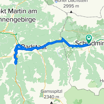
Schladming-Zell am See(teils Tauernradweg)
A cycling route starting in Schladming, Styria, Austria.
Overview
About this route
Etappe 4 Perchtoldsdorf-Lienz
teilweise auf dem Tauernradweg sehr schön, nicht immer gut beschriftet, dann vor Lend sehr verwirrend und in Folge steil/viele Höhenmeter-trotzdem schön,
107km, 900hm !
- -:--
- Duration
- 88.4 km
- Distance
- 625 m
- Ascent
- 598 m
- Descent
- ---
- Avg. speed
- ---
- Max. altitude
Route quality
Waytypes & surfaces along the route
Waytypes
Busy road
33.6 km
(38 %)
Quiet road
20.7 km
(23 %)
Surfaces
Paved
67.5 km
(76 %)
Unpaved
9.7 km
(11 %)
Asphalt
66.2 km
(75 %)
Gravel
8.6 km
(10 %)
Continue with Bikemap
Use, edit, or download this cycling route
You would like to ride Schladming-Zell am See(teils Tauernradweg) or customize it for your own trip? Here is what you can do with this Bikemap route:
Free features
- Save this route as favorite or in collections
- Copy & plan your own version of this route
- Split it into stages to create a multi-day tour
- Sync your route with Garmin or Wahoo
Premium features
Free trial for 3 days, or one-time payment. More about Bikemap Premium.
- Navigate this route on iOS & Android
- Export a GPX / KML file of this route
- Create your custom printout (try it for free)
- Download this route for offline navigation
Discover more Premium features.
Get Bikemap PremiumFrom our community
Other popular routes starting in Schladming
 Einrollen Ramsau 21.07.2014
- Distance
- 26.7 km
- Ascent
- 432 m
- Descent
- 432 m
- Location
- Schladming, Styria, Austria
 Rohrmoos Tour
- Distance
- 26.4 km
- Ascent
- 505 m
- Descent
- 504 m
- Location
- Schladming, Styria, Austria
 Sonnseitn Tour
- Distance
- 26.4 km
- Ascent
- 518 m
- Descent
- 518 m
- Location
- Schladming, Styria, Austria
 Planai
- Distance
- 17.9 km
- Ascent
- 1,105 m
- Descent
- 96 m
- Location
- Schladming, Styria, Austria
 Schladming Flachau Rundweg
- Distance
- 61.3 km
- Ascent
- 224 m
- Descent
- 223 m
- Location
- Schladming, Styria, Austria
 Top 6 Schladming 08 medium
- Distance
- 47.4 km
- Ascent
- 1,654 m
- Descent
- 1,661 m
- Location
- Schladming, Styria, Austria
 Rakousko 2012-8.den-21.7.So
- Distance
- 29.6 km
- Ascent
- 274 m
- Descent
- 624 m
- Location
- Schladming, Styria, Austria
 Ramsau Tuerlwand
- Distance
- 32.8 km
- Ascent
- 1,350 m
- Descent
- 1,350 m
- Location
- Schladming, Styria, Austria
Open it in the app