
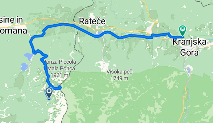
2 Rifugio Zacchi - Kranjska Gora
A cycling route starting in Kranjska Gora, Kranjska Gora, Slovenia.
Overview
About this route
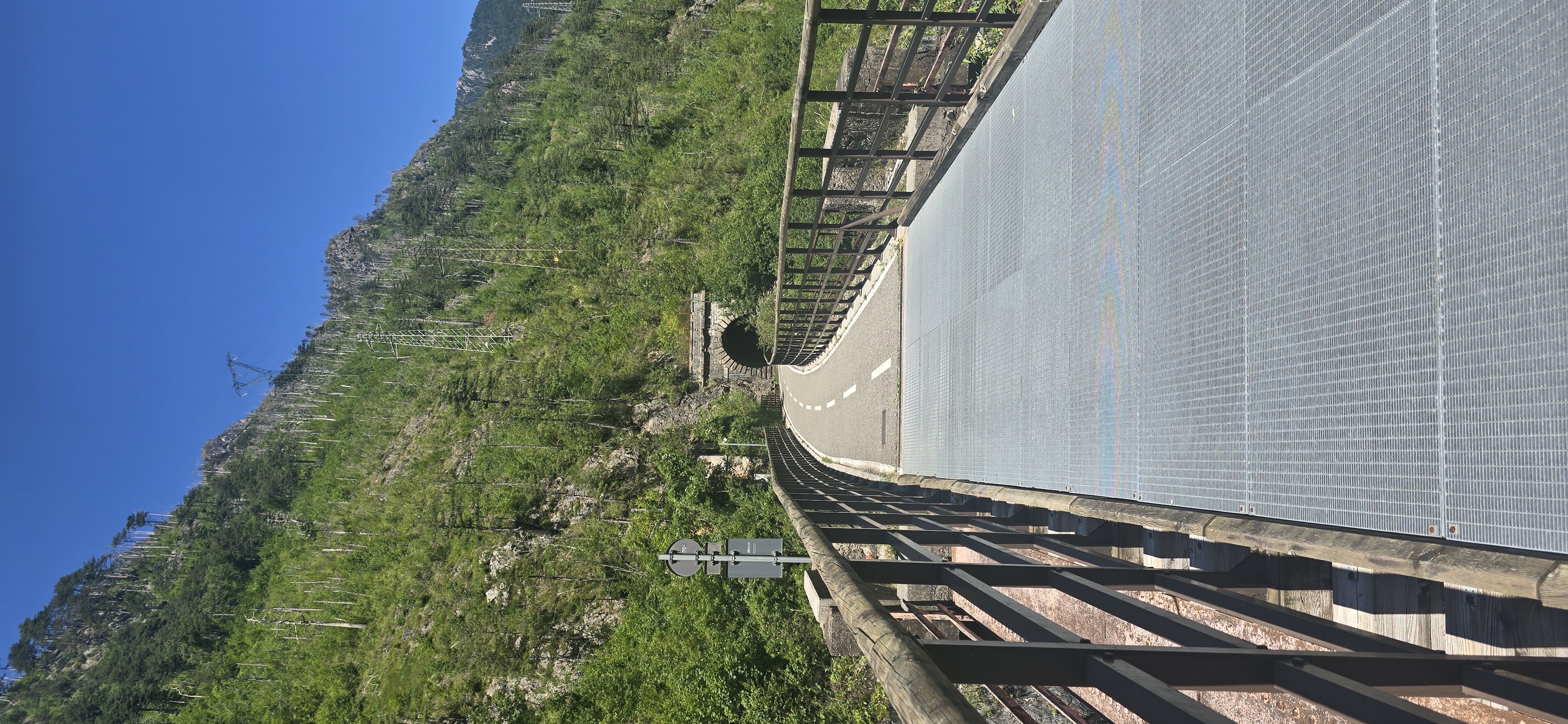
Vom Rifugio Zacchi führt der Weg hinunter zum unteren Fusine-See, dann zum Fusine-Pass und weiter nach Kranjska Gora. Es lohnt sich, eine kurze Pause im Naturschutzgebiet Zelenci zu machen, mit zahlreichen Quellen, einem smaragdgrünen See und seltenen und gefährdeten Tier- und Pflanzenarten. Wir folgen den Spuren des berühmten Naturwissenschaftlers Sir Humphry Davy, der einmal gesagt hat: "Am liebsten mag ich das Sava-Tal mit seinen Wasserfällen und Seen, und ich kenne nichts Besseres in Europa."
- 1 h 24 min
- Duration
- 16.3 km
- Distance
- 686 m
- Ascent
- 1,235 m
- Descent
- 11.6 km/h
- Avg. speed
- 1,825 m
- Max. altitude

Route quality
Waytypes & surfaces along the route
Waytypes
Track
0.8 km
(5 %)
Path
0.8 km
(5 %)
Surfaces
Paved
0.5 km
(3 %)
Unpaved
0.8 km
(5 %)
Gravel
0.8 km
(5 %)
Asphalt
0.3 km
(2 %)
Continue with Bikemap
Use, edit, or download this cycling route
You would like to ride 2 Rifugio Zacchi - Kranjska Gora or customize it for your own trip? Here is what you can do with this Bikemap route:
Free features
- Save this route as favorite or in collections
- Copy & plan your own version of this route
- Sync your route with Garmin or Wahoo
Premium features
Free trial for 3 days, or one-time payment. More about Bikemap Premium.
- Navigate this route on iOS & Android
- Export a GPX / KML file of this route
- Create your custom printout (try it for free)
- Download this route for offline navigation
Discover more Premium features.
Get Bikemap PremiumFrom our community
Other popular routes starting in Kranjska Gora
 Giorno 2
- Distance
- 103.4 km
- Ascent
- 1,621 m
- Descent
- 2,174 m
- Location
- Kranjska Gora, Kranjska Gora, Slovenia
 Kranjska Gora - Sv. Duh
- Distance
- 69.8 km
- Ascent
- 1,177 m
- Descent
- 1,604 m
- Location
- Kranjska Gora, Kranjska Gora, Slovenia
 Kranjska Gora - Belopeška - Valbruna
- Distance
- 59.8 km
- Ascent
- 1,178 m
- Descent
- 1,177 m
- Location
- Kranjska Gora, Kranjska Gora, Slovenia
 Vitranška ulica, Kranjska Gora - Largo Piave, Tarvisio
- Distance
- 26 km
- Ascent
- 507 m
- Descent
- 615 m
- Location
- Kranjska Gora, Kranjska Gora, Slovenia
 Borovška cesta - Via Vittorio Veneto
- Distance
- 122 km
- Ascent
- 418 m
- Descent
- 1,158 m
- Location
- Kranjska Gora, Kranjska Gora, Slovenia
 ALPE Dzień 5 - Camp Spik, Kranjska Gora - Camp Lago, Interneppo
- Distance
- 99.6 km
- Ascent
- 1,386 m
- Descent
- 1,927 m
- Location
- Kranjska Gora, Kranjska Gora, Slovenia
 Rateče, Rateče Planica to Gozd Martuljek, Gozd Martuljek
- Distance
- 19.2 km
- Ascent
- 58 m
- Descent
- 419 m
- Location
- Kranjska Gora, Kranjska Gora, Slovenia
 Giorno 2
- Distance
- 103.8 km
- Ascent
- 1,474 m
- Descent
- 2,027 m
- Location
- Kranjska Gora, Kranjska Gora, Slovenia
Open it in the app