
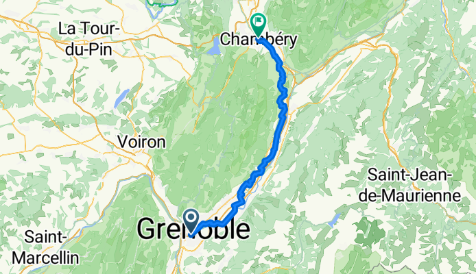
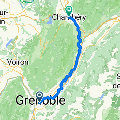
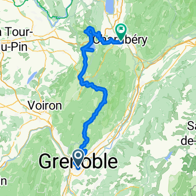
Grenoble Chambéry
A cycling route starting in Grenoble, Auvergne-Rhône-Alpes, France.
Overview
About this route
- 4 h 16 min
- Duration
- 70.4 km
- Distance
- 498 m
- Ascent
- 449 m
- Descent
- 16.5 km/h
- Avg. speed
- 443 m
- Max. altitude
Route quality
Waytypes & surfaces along the route
Waytypes
Quiet road
38 km
(54 %)
Path
15.5 km
(22 %)
Surfaces
Paved
52.8 km
(75 %)
Unpaved
2.1 km
(3 %)
Asphalt
52.1 km
(74 %)
Gravel
1.4 km
(2 %)
Continue with Bikemap
Use, edit, or download this cycling route
You would like to ride Grenoble Chambéry or customize it for your own trip? Here is what you can do with this Bikemap route:
Free features
- Save this route as favorite or in collections
- Copy & plan your own version of this route
- Sync your route with Garmin or Wahoo
Premium features
Free trial for 3 days, or one-time payment. More about Bikemap Premium.
- Navigate this route on iOS & Android
- Export a GPX / KML file of this route
- Create your custom printout (try it for free)
- Download this route for offline navigation
Discover more Premium features.
Get Bikemap PremiumFrom our community
Other popular routes starting in Grenoble
 Lac De Laffrey
- Distance
- 79.4 km
- Ascent
- 1,119 m
- Descent
- 1,119 m
- Location
- Grenoble, Auvergne-Rhône-Alpes, France
 Grenoble Chambéry
- Distance
- 70.4 km
- Ascent
- 498 m
- Descent
- 449 m
- Location
- Grenoble, Auvergne-Rhône-Alpes, France
 Quick bike tour through Le Pont-de-Claix
- Distance
- 6.5 km
- Ascent
- 22 m
- Descent
- 0 m
- Location
- Grenoble, Auvergne-Rhône-Alpes, France
 Entraînement - Chartreuse
- Distance
- 24.7 km
- Ascent
- 544 m
- Descent
- 544 m
- Location
- Grenoble, Auvergne-Rhône-Alpes, France
 grenoble - cognin-les-gorges
- Distance
- 123.1 km
- Ascent
- 2,095 m
- Descent
- 2,100 m
- Location
- Grenoble, Auvergne-Rhône-Alpes, France
 Grenoble - Chambéry
- Distance
- 104.5 km
- Ascent
- 2,217 m
- Descent
- 2,143 m
- Location
- Grenoble, Auvergne-Rhône-Alpes, France
 5 March 23, Saint Laurent (with Ste)
- Distance
- 7.4 km
- Ascent
- 40 m
- Descent
- 42 m
- Location
- Grenoble, Auvergne-Rhône-Alpes, France
 CRI Grenoble-Grenoble (Tour 2011)
- Distance
- 42.5 km
- Ascent
- 616 m
- Descent
- 620 m
- Location
- Grenoble, Auvergne-Rhône-Alpes, France
Open it in the app