
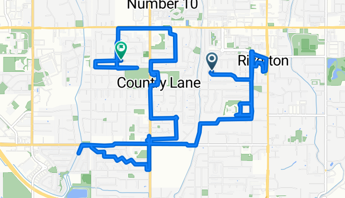
S 2200 W, Riverton to W 12825 S, Riverton
A cycling route starting in Riverton, Utah, United States.
Overview
About this route
- 1 h 10 min
- Duration
- 14.7 km
- Distance
- 454 m
- Ascent
- 434 m
- Descent
- 12.6 km/h
- Avg. speed
- 1,394 m
- Max. altitude
Route photos


Continue with Bikemap
Use, edit, or download this cycling route
You would like to ride S 2200 W, Riverton to W 12825 S, Riverton or customize it for your own trip? Here is what you can do with this Bikemap route:
Free features
- Save this route as favorite or in collections
- Copy & plan your own version of this route
- Sync your route with Garmin or Wahoo
Premium features
Free trial for 3 days, or one-time payment. More about Bikemap Premium.
- Navigate this route on iOS & Android
- Export a GPX / KML file of this route
- Create your custom printout (try it for free)
- Download this route for offline navigation
Discover more Premium features.
Get Bikemap PremiumFrom our community
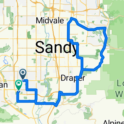
Other popular routes starting in Riverton
- S 2200 W, Riverton to W 12825 S, Riverton
- Distance
- 14.7 km
- Ascent
- 454 m
- Descent
- 434 m
- Location
- Riverton, Utah, United States
 work to home
- Distance
- 26.6 km
- Ascent
- 164 m
- Descent
- 181 m
- Location
- Riverton, Utah, United States
 20MAY13
- Distance
- 48.4 km
- Ascent
- 317 m
- Descent
- 317 m
- Location
- Riverton, Utah, United States
 16JUN13
- Distance
- 48.2 km
- Ascent
- 424 m
- Descent
- 424 m
- Location
- Riverton, Utah, United States
 Creek Meadow Road 3662, Riverton to Creek Meadow Road 3662, Riverton
- Distance
- 11.2 km
- Ascent
- 50 m
- Descent
- 50 m
- Location
- Riverton, Utah, United States
 08OCT13
- Distance
- 69.3 km
- Ascent
- 547 m
- Descent
- 537 m
- Location
- Riverton, Utah, United States
 Relaxed route in Riverton
- Distance
- 18.3 km
- Ascent
- 142 m
- Descent
- 145 m
- Location
- Riverton, Utah, United States
 Lengthy Monday Route In Draper
- Distance
- 14.8 km
- Ascent
- 403 m
- Descent
- 389 m
- Location
- Riverton, Utah, United States
Open it in the app