

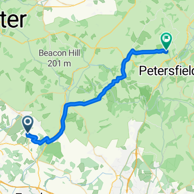
50.931, -1.203 to 51.028, -0.943
A cycling route starting in Swanmore, England, United Kingdom.
Overview
About this route
- 3 h 40 min
- Duration
- 29.9 km
- Distance
- 533 m
- Ascent
- 492 m
- Descent
- 8.2 km/h
- Avg. speed
- 236 m
- Max. altitude
Route quality
Waytypes & surfaces along the route
Waytypes
Quiet road
19.5 km
(65 %)
Track
7.8 km
(26 %)
Surfaces
Paved
18 km
(60 %)
Unpaved
6.9 km
(23 %)
Asphalt
18 km
(60 %)
Gravel
6.3 km
(21 %)
Continue with Bikemap
Use, edit, or download this cycling route
You would like to ride 50.931, -1.203 to 51.028, -0.943 or customize it for your own trip? Here is what you can do with this Bikemap route:
Free features
- Save this route as favorite or in collections
- Copy & plan your own version of this route
- Sync your route with Garmin or Wahoo
Premium features
Free trial for 3 days, or one-time payment. More about Bikemap Premium.
- Navigate this route on iOS & Android
- Export a GPX / KML file of this route
- Create your custom printout (try it for free)
- Download this route for offline navigation
Discover more Premium features.
Get Bikemap PremiumFrom our community
Other popular routes starting in Swanmore
 around beacon hill
- Distance
- 27.7 km
- Ascent
- 333 m
- Descent
- 331 m
- Location
- Swanmore, England, United Kingdom
 Cheesefoot - Meonstoke loop
- Distance
- 33.2 km
- Ascent
- 399 m
- Descent
- 385 m
- Location
- Swanmore, England, United Kingdom
 old winchester hill and east meon
- Distance
- 18.4 km
- Ascent
- 176 m
- Descent
- 176 m
- Location
- Swanmore, England, United Kingdom
 Warnford to Butser
- Distance
- 13.8 km
- Ascent
- 263 m
- Descent
- 208 m
- Location
- Swanmore, England, United Kingdom
 West Meon to Park Gate20
- Distance
- 32.8 km
- Ascent
- 264 m
- Descent
- 301 m
- Location
- Swanmore, England, United Kingdom
 50.931, -1.203 to 51.028, -0.943
- Distance
- 29.9 km
- Ascent
- 533 m
- Descent
- 492 m
- Location
- Swanmore, England, United Kingdom
 Spred Out Sunday Track In Waterlooville
- Distance
- 30.1 km
- Ascent
- 267 m
- Descent
- 404 m
- Location
- Swanmore, England, United Kingdom
 Meonstoke-Tollard Royal
- Distance
- 89.3 km
- Ascent
- 454 m
- Descent
- 407 m
- Location
- Swanmore, England, United Kingdom
Open it in the app