

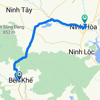
Nha Tran Hill Climb
A cycling route starting in Khánh Vĩnh, Khánh Hòa Province, Vietnam.
Overview
About this route
- -:--
- Duration
- 32 km
- Distance
- 1,837 m
- Ascent
- 226 m
- Descent
- ---
- Avg. speed
- ---
- Max. altitude

Continue with Bikemap
Use, edit, or download this cycling route
You would like to ride Nha Tran Hill Climb or customize it for your own trip? Here is what you can do with this Bikemap route:
Free features
- Save this route as favorite or in collections
- Copy & plan your own version of this route
- Sync your route with Garmin or Wahoo
Premium features
Free trial for 3 days, or one-time payment. More about Bikemap Premium.
- Navigate this route on iOS & Android
- Export a GPX / KML file of this route
- Create your custom printout (try it for free)
- Download this route for offline navigation
Discover more Premium features.
Get Bikemap PremiumFrom our community
Other popular routes starting in Khánh Vĩnh
 Nha Tran Hill Climb
- Distance
- 32 km
- Ascent
- 1,837 m
- Descent
- 226 m
- Location
- Khánh Vĩnh, Khánh Hòa Province, Vietnam
 Day 43 - Viewpoint to Dalat
- Distance
- 66.7 km
- Ascent
- 1,792 m
- Descent
- 991 m
- Location
- Khánh Vĩnh, Khánh Hòa Province, Vietnam
 Blistering ride
- Distance
- 54.8 km
- Ascent
- 121 m
- Descent
- 116 m
- Location
- Khánh Vĩnh, Khánh Hòa Province, Vietnam
 Đèo Hòn Giao
- Distance
- 31.7 km
- Ascent
- 1,861 m
- Descent
- 239 m
- Location
- Khánh Vĩnh, Khánh Hòa Province, Vietnam
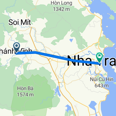 Khánh Vĩnh - Nha Trang
- Distance
- 30.4 km
- Ascent
- 0 m
- Descent
- 59 m
- Location
- Khánh Vĩnh, Khánh Hòa Province, Vietnam
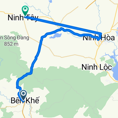
 Trạm Khánh Vĩnh - Ninh Hoà
- Distance
- 37.6 km
- Ascent
- 63 m
- Descent
- 106 m
- Location
- Khánh Vĩnh, Khánh Hòa Province, Vietnam
 Trạm Khánh Vĩnh - Ninh Hoà
- Distance
- 36.7 km
- Ascent
- 77 m
- Descent
- 151 m
- Location
- Khánh Vĩnh, Khánh Hòa Province, Vietnam
Open it in the app