
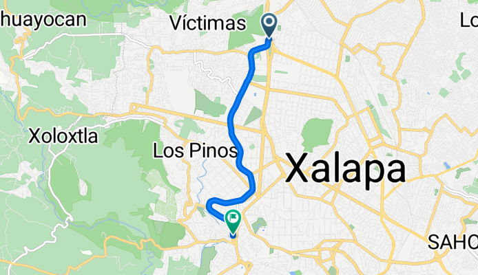
De Avenida Lázaro Cárdenas Y Plaza Crital a Calle Ignacio de la Llave
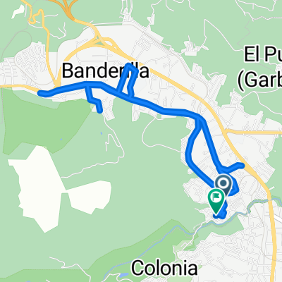
A cycling route starting in Banderilla, Veracruz, Mexico.
Overview
About this route
- 2 h 7 min
- Duration
- 5.6 km
- Distance
- 63 m
- Ascent
- 122 m
- Descent
- 2.6 km/h
- Avg. speed
- 1,486 m
- Max. altitude

Route photos


Continue with Bikemap
Use, edit, or download this cycling route
You would like to ride De Avenida Lázaro Cárdenas Y Plaza Crital a Calle Ignacio de la Llave or customize it for your own trip? Here is what you can do with this Bikemap route:
Free features
- Save this route as favorite or in collections
- Copy & plan your own version of this route
- Sync your route with Garmin or Wahoo
Premium features
Free trial for 3 days, or one-time payment. More about Bikemap Premium.
- Navigate this route on iOS & Android
- Export a GPX / KML file of this route
- Create your custom printout (try it for free)
- Download this route for offline navigation
Discover more Premium features.
Get Bikemap PremiumFrom our community
Other popular routes starting in Banderilla
- De Avenida Lázaro Cárdenas Y Plaza Crital a Calle Ignacio de la Llave
- Distance
- 5.6 km
- Ascent
- 63 m
- Descent
- 122 m
- Location
- Banderilla, Veracruz, Mexico
 De Calle Lino Serrano 17, Banderilla a Segunda Privada Lino Serrano 3, Banderilla
- Distance
- 9.4 km
- Ascent
- 131 m
- Descent
- 103 m
- Location
- Banderilla, Veracruz, Mexico
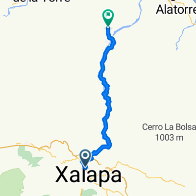 Xalapa - Misantla
- Distance
- 74.4 km
- Ascent
- 1,318 m
- Descent
- 2,476 m
- Location
- Banderilla, Veracruz, Mexico
 De Calle Desviación Sedeño 8, Xalapa-Enríquez a Cuarta Privada Desviación Sedeño, Xalapa-Enríquez
- Distance
- 13.3 km
- Ascent
- 190 m
- Descent
- 182 m
- Location
- Banderilla, Veracruz, Mexico
 De Fco Pimentel 8, Banderilla a Fco Pimentel 39, Banderilla
- Distance
- 30.7 km
- Ascent
- 1,262 m
- Descent
- 1,266 m
- Location
- Banderilla, Veracruz, Mexico
 boca del rio CCBR fase 6
- Distance
- 122.1 km
- Ascent
- 589 m
- Descent
- 2,087 m
- Location
- Banderilla, Veracruz, Mexico
 De Fco Pimentel a Calle Fidel Cruz Martínez.
- Distance
- 9.4 km
- Ascent
- 133 m
- Descent
- 111 m
- Location
- Banderilla, Veracruz, Mexico
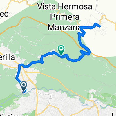 De Calle Fidel Cruz Martínez. a Víctor Acosta
- Distance
- 15.3 km
- Ascent
- 571 m
- Descent
- 645 m
- Location
- Banderilla, Veracruz, Mexico
Open it in the app