
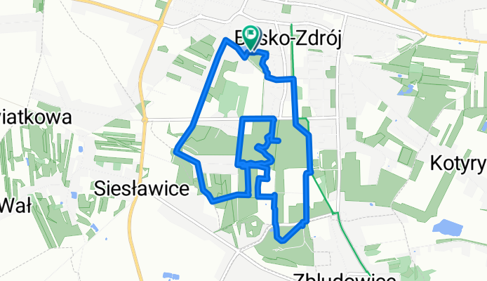
Rajd Rowerowy Pirania
A cycling route starting in Busko-Zdrój, Świętokrzyskie Voivodship, Poland.
Overview
About this route
- 1 h 2 min
- Duration
- 8.4 km
- Distance
- 73 m
- Ascent
- 73 m
- Descent
- 8.2 km/h
- Avg. speed
- 243 m
- Max. altitude

Route quality
Waytypes & surfaces along the route
Waytypes
Quiet road
3.3 km
(39 %)
Pedestrian area
3 km
(35 %)
Surfaces
Paved
3.9 km
(46 %)
Unpaved
0.8 km
(10 %)
Asphalt
3.6 km
(43 %)
Gravel
0.6 km
(7 %)
Continue with Bikemap
Use, edit, or download this cycling route
You would like to ride Rajd Rowerowy Pirania or customize it for your own trip? Here is what you can do with this Bikemap route:
Free features
- Save this route as favorite or in collections
- Copy & plan your own version of this route
- Sync your route with Garmin or Wahoo
Premium features
Free trial for 3 days, or one-time payment. More about Bikemap Premium.
- Navigate this route on iOS & Android
- Export a GPX / KML file of this route
- Create your custom printout (try it for free)
- Download this route for offline navigation
Discover more Premium features.
Get Bikemap PremiumFrom our community
Other popular routes starting in Busko-Zdrój
 2 dzień BUSKO ZDRÓJ - SANDOMIERZ GVelo
- Distance
- 98.2 km
- Ascent
- 258 m
- Descent
- 339 m
- Location
- Busko-Zdrój, Świętokrzyskie Voivodship, Poland
 Tadeusza Kościuszki 32, Busko-Zdrój do Tadeusza Kościuszki 32, Busko-Zdrój
- Distance
- 15.4 km
- Ascent
- 101 m
- Descent
- 153 m
- Location
- Busko-Zdrój, Świętokrzyskie Voivodship, Poland
 2 dzień BUSKO ZDRÓJ - SANDOMIERZ
- Distance
- 94.1 km
- Ascent
- 245 m
- Descent
- 280 m
- Location
- Busko-Zdrój, Świętokrzyskie Voivodship, Poland
 Tadeusza Kościuszki 32, Busko-Zdrój do Kilińskiego 17, Busko-Zdrój
- Distance
- 21.8 km
- Ascent
- 268 m
- Descent
- 314 m
- Location
- Busko-Zdrój, Świętokrzyskie Voivodship, Poland
 Kilińskiega 17, Busko-Zdrój do Kilińskiego 17, Busko-Zdrój
- Distance
- 16.3 km
- Ascent
- 85 m
- Descent
- 127 m
- Location
- Busko-Zdrój, Świętokrzyskie Voivodship, Poland
 Z Ponidzia na Piotrków
- Distance
- 182.1 km
- Ascent
- 395 m
- Descent
- 448 m
- Location
- Busko-Zdrój, Świętokrzyskie Voivodship, Poland
 Tadeusza Kościuszki 30, Busko-Zdrój do Tadeusza Kościuszki 32, Busko-Zdrój
- Distance
- 15.6 km
- Ascent
- 103 m
- Descent
- 106 m
- Location
- Busko-Zdrój, Świętokrzyskie Voivodship, Poland
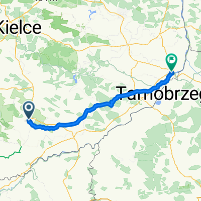
 Droga Krajowa 73, Busko-Zdrój do Stopnicka 25, Nowy Korczyn
- Distance
- 110 km
- Ascent
- 851 m
- Descent
- 937 m
- Location
- Busko-Zdrój, Świętokrzyskie Voivodship, Poland
Open it in the app