
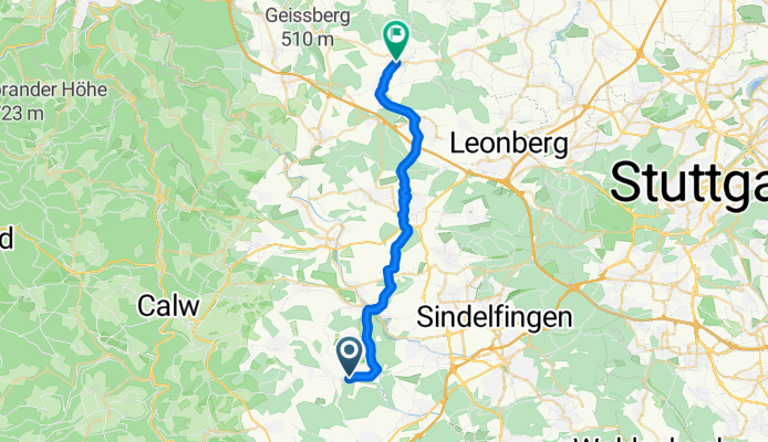
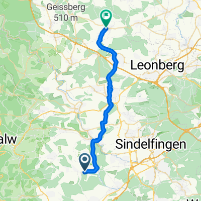
Tannenweg nach Bachstraße
A cycling route starting in Aidlingen, Baden-Wurttemberg, Germany.
Overview
About this route
- 1 h 48 min
- Duration
- 26.8 km
- Distance
- 233 m
- Ascent
- 352 m
- Descent
- 14.9 km/h
- Avg. speed
- 489 m
- Max. altitude
Route quality
Waytypes & surfaces along the route
Waytypes
Track
11.5 km
(43 %)
Quiet road
5.9 km
(22 %)
Surfaces
Paved
24.9 km
(93 %)
Unpaved
0.5 km
(2 %)
Asphalt
22 km
(82 %)
Paved (undefined)
2.9 km
(11 %)
Continue with Bikemap
Use, edit, or download this cycling route
You would like to ride Tannenweg nach Bachstraße or customize it for your own trip? Here is what you can do with this Bikemap route:
Free features
- Save this route as favorite or in collections
- Copy & plan your own version of this route
- Sync your route with Garmin or Wahoo
Premium features
Free trial for 3 days, or one-time payment. More about Bikemap Premium.
- Navigate this route on iOS & Android
- Export a GPX / KML file of this route
- Create your custom printout (try it for free)
- Download this route for offline navigation
Discover more Premium features.
Get Bikemap PremiumFrom our community
Other popular routes starting in Aidlingen
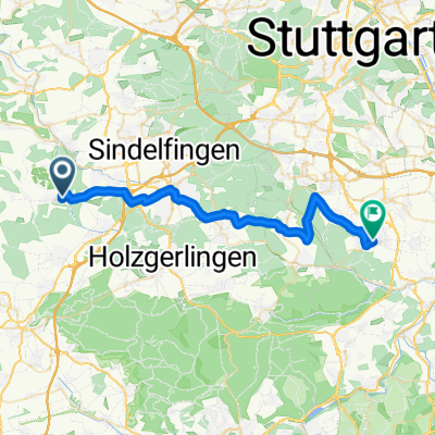
 Deufringen-7 Tannen-Gültlingen-Sulz a. Eck-Kuppingen-Gärtringen-Aidlingen
- Distance
- 32.7 km
- Ascent
- 373 m
- Descent
- 372 m
- Location
- Aidlingen, Baden-Wurttemberg, Germany
 Darmsheim - Weil dS - Stuttgart und zurück
- Distance
- 67.4 km
- Ascent
- 490 m
- Descent
- 490 m
- Location
- Aidlingen, Baden-Wurttemberg, Germany
 von Aidlingen nach Renningen
- Distance
- 30.1 km
- Ascent
- 320 m
- Descent
- 383 m
- Location
- Aidlingen, Baden-Wurttemberg, Germany
 Tour 020 Aichhalden - Gültlingen - Teinach -
- Distance
- 91.5 km
- Ascent
- 762 m
- Descent
- 760 m
- Location
- Aidlingen, Baden-Wurttemberg, Germany
 Tannenweg nach Bachstraße
- Distance
- 26.8 km
- Ascent
- 233 m
- Descent
- 352 m
- Location
- Aidlingen, Baden-Wurttemberg, Germany
 Böblinger - Sindelfinger Radelrund
- Distance
- 37.3 km
- Ascent
- 299 m
- Descent
- 298 m
- Location
- Aidlingen, Baden-Wurttemberg, Germany
 Garten Leonberg
- Distance
- 25.9 km
- Ascent
- 502 m
- Descent
- 509 m
- Location
- Aidlingen, Baden-Wurttemberg, Germany
 Aidlingen -> Fildorado
- Distance
- 32.1 km
- Ascent
- 352 m
- Descent
- 396 m
- Location
- Aidlingen, Baden-Wurttemberg, Germany
Open it in the app