

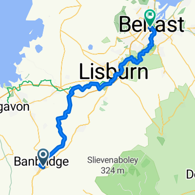
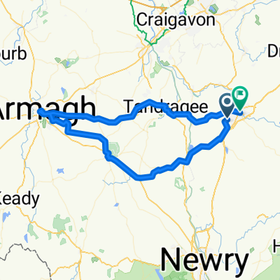
Banbridge (Round the Mournes)
A cycling route starting in Banbridge, Northern Ireland, United Kingdom.
Overview
About this route
A good few hills followed by a reasonably flat cycle home.
- -:--
- Duration
- 124.4 km
- Distance
- 551 m
- Ascent
- 540 m
- Descent
- ---
- Avg. speed
- ---
- Max. altitude
Route quality
Waytypes & surfaces along the route
Waytypes
Quiet road
24.9 km
(20 %)
Cycleway
24.9 km
(20 %)
Surfaces
Paved
99.5 km
(80 %)
Asphalt
99.5 km
(80 %)
Undefined
24.9 km
(20 %)
Continue with Bikemap
Use, edit, or download this cycling route
You would like to ride Banbridge (Round the Mournes) or customize it for your own trip? Here is what you can do with this Bikemap route:
Free features
- Save this route as favorite or in collections
- Copy & plan your own version of this route
- Split it into stages to create a multi-day tour
- Sync your route with Garmin or Wahoo
Premium features
Free trial for 3 days, or one-time payment. More about Bikemap Premium.
- Navigate this route on iOS & Android
- Export a GPX / KML file of this route
- Create your custom printout (try it for free)
- Download this route for offline navigation
Discover more Premium features.
Get Bikemap PremiumFrom our community
Other popular routes starting in Banbridge
 1–3 Old Coach Hill, Banbridge to 1–3 Old Coach Hill, Banbridge
- Distance
- 83.2 km
- Ascent
- 860 m
- Descent
- 860 m
- Location
- Banbridge, Northern Ireland, United Kingdom
 Home - Katesbridge - Kilkinamurray - Home
- Distance
- 46.2 km
- Ascent
- 365 m
- Descent
- 365 m
- Location
- Banbridge, Northern Ireland, United Kingdom
 6 Banbridge - Belfast
- Distance
- 56.1 km
- Ascent
- 388 m
- Descent
- 453 m
- Location
- Banbridge, Northern Ireland, United Kingdom
 Brookfield Meadows 26 to Maryville Drive 34
- Distance
- 2 km
- Ascent
- 22 m
- Descent
- 13 m
- Location
- Banbridge, Northern Ireland, United Kingdom
 Banbridge Garland Rural as much as poss
- Distance
- 47.2 km
- Ascent
- 430 m
- Descent
- 408 m
- Location
- Banbridge, Northern Ireland, United Kingdom
 2–4 Main St, Loughbrickland, Banbridge to 32 Church Sq, Rathfriland, Newry
- Distance
- 14.1 km
- Ascent
- 232 m
- Descent
- 156 m
- Location
- Banbridge, Northern Ireland, United Kingdom
 HomeRide
- Distance
- 17.4 km
- Ascent
- 179 m
- Descent
- 190 m
- Location
- Banbridge, Northern Ireland, United Kingdom
 6–10 Old Coach Hill, Banbridge to Gospel Lane, Banbridge
- Distance
- 64.1 km
- Ascent
- 440 m
- Descent
- 500 m
- Location
- Banbridge, Northern Ireland, United Kingdom
Open it in the app