

Sherwood - Byron
A cycling route starting in Rocklea, Queensland, Australia.
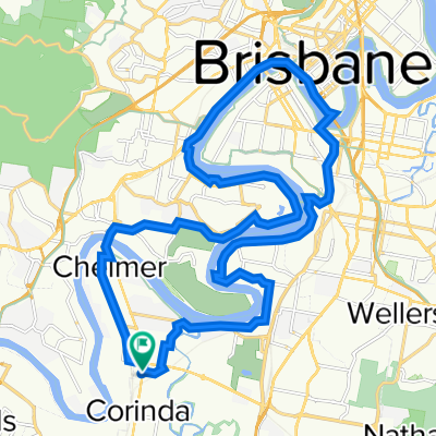
Overview
About this route
One day road ride from Brisbane to Byron Bay with least traffic possible.
- -:--
- Duration
- 185 km
- Distance
- 221 m
- Ascent
- 227 m
- Descent
- ---
- Avg. speed
- ---
- Max. altitude
Continue with Bikemap
Use, edit, or download this cycling route
You would like to ride Sherwood - Byron or customize it for your own trip? Here is what you can do with this Bikemap route:
Free features
- Save this route as favorite or in collections
- Copy & plan your own version of this route
- Split it into stages to create a multi-day tour
- Sync your route with Garmin or Wahoo
Premium features
Free trial for 3 days, or one-time payment. More about Bikemap Premium.
- Navigate this route on iOS & Android
- Export a GPX / KML file of this route
- Create your custom printout (try it for free)
- Download this route for offline navigation
Discover more Premium features.
Get Bikemap PremiumFrom our community
Other popular routes starting in Rocklea
 Graceville-Seventeen Mile Rocks-Toowong loop
- Distance
- 37.1 km
- Ascent
- 224 m
- Descent
- 222 m
- Location
- Rocklea, Queensland, Australia
 Sherwood-M3-River Loop
- Distance
- 59.2 km
- Ascent
- 245 m
- Descent
- 245 m
- Location
- Rocklea, Queensland, Australia
 539 Oxley Rd, Sherwood to 531 Oxley Rd, Sherwood
- Distance
- 31.7 km
- Ascent
- 236 m
- Descent
- 236 m
- Location
- Rocklea, Queensland, Australia
 Oxley Road 661, Corinda to William Street 35, Imbil
- Distance
- 165.5 km
- Ascent
- 2,690 m
- Descent
- 2,626 m
- Location
- Rocklea, Queensland, Australia
 507 Oxley Rd, Sherwood to 535 Oxley Rd, Sherwood
- Distance
- 33.7 km
- Ascent
- 286 m
- Descent
- 288 m
- Location
- Rocklea, Queensland, Australia
 River Loop from Sherwood
- Distance
- 33.8 km
- Ascent
- 0 m
- Descent
- 16 m
- Location
- Rocklea, Queensland, Australia
 Sherwood - Greenbank Army Loop
- Distance
- 65.6 km
- Ascent
- 290 m
- Descent
- 290 m
- Location
- Rocklea, Queensland, Australia
 Paseo intenso en Oxley
- Distance
- 51.8 km
- Ascent
- 1,351 m
- Descent
- 1,335 m
- Location
- Rocklea, Queensland, Australia
Open it in the app