
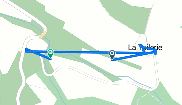
Route de la Tuilerie to La Tuilerie
A cycling route starting in Limoux, Occitanie, France.
Overview
About this route
- 2 h 11 min
- Duration
- 1.2 km
- Distance
- 3 m
- Ascent
- 38 m
- Descent
- 0.6 km/h
- Avg. speed
- 342 m
- Max. altitude
Route photos


Continue with Bikemap
Use, edit, or download this cycling route
You would like to ride Route de la Tuilerie to La Tuilerie or customize it for your own trip? Here is what you can do with this Bikemap route:
Free features
- Save this route as favorite or in collections
- Copy & plan your own version of this route
- Sync your route with Garmin or Wahoo
Premium features
Free trial for 3 days, or one-time payment. More about Bikemap Premium.
- Navigate this route on iOS & Android
- Export a GPX / KML file of this route
- Create your custom printout (try it for free)
- Download this route for offline navigation
Discover more Premium features.
Get Bikemap PremiumFrom our community
Other popular routes starting in Limoux
 15. Limoux / Foix
- Distance
- 199.2 km
- Ascent
- 2,606 m
- Descent
- 2,392 m
- Location
- Limoux, Occitanie, France
 Boucle route Limoux
- Distance
- 117 km
- Ascent
- 1,311 m
- Descent
- 1,311 m
- Location
- Limoux, Occitanie, France
 Magic ride
- Distance
- 57.6 km
- Ascent
- 473 m
- Descent
- 473 m
- Location
- Limoux, Occitanie, France
 Boucle cyclo Limoux - Saint-Salvayre
- Distance
- 58 km
- Ascent
- 840 m
- Descent
- 840 m
- Location
- Limoux, Occitanie, France
 Tour de France - Etappe 15
- Distance
- 188.8 km
- Ascent
- 566 m
- Descent
- 699 m
- Location
- Limoux, Occitanie, France
 Limoux - Foix 68km 510u,300d,4h30
- Distance
- 67.9 km
- Ascent
- 502 m
- Descent
- 295 m
- Location
- Limoux, Occitanie, France
 limoux pred andorru
- Distance
- 104.1 km
- Ascent
- 2,011 m
- Descent
- 773 m
- Location
- Limoux, Occitanie, France
 laGrasse
- Distance
- 106.8 km
- Ascent
- 870 m
- Descent
- 870 m
- Location
- Limoux, Occitanie, France
Open it in the app