
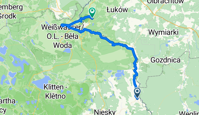
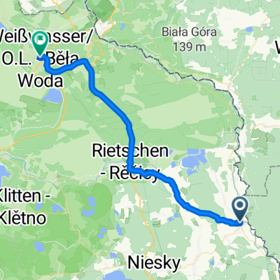
Wypad do Mużaka- dzień drugi
A cycling route starting in Pieńsk, Lower Silesian Voivodeship, Poland.
Overview
About this route
- 8 h 24 min
- Duration
- 65.5 km
- Distance
- 1,031 m
- Ascent
- 1,070 m
- Descent
- 7.8 km/h
- Avg. speed
- 299 m
- Max. altitude

Route photos


Continue with Bikemap
Use, edit, or download this cycling route
You would like to ride Wypad do Mużaka- dzień drugi or customize it for your own trip? Here is what you can do with this Bikemap route:
Free features
- Save this route as favorite or in collections
- Copy & plan your own version of this route
- Sync your route with Garmin or Wahoo
Premium features
Free trial for 3 days, or one-time payment. More about Bikemap Premium.
- Navigate this route on iOS & Android
- Export a GPX / KML file of this route
- Create your custom printout (try it for free)
- Download this route for offline navigation
Discover more Premium features.
Get Bikemap PremiumFrom our community
Other popular routes starting in Pieńsk
 Oder-Neiße-Radweg Tag 3
- Distance
- 108.4 km
- Ascent
- 349 m
- Descent
- 470 m
- Location
- Pieńsk, Lower Silesian Voivodeship, Poland
- Pieńsk-Gubin
- Distance
- 126.8 km
- Ascent
- ---
- Descent
- ---
- Location
- Pieńsk, Lower Silesian Voivodeship, Poland
 Rothenburg - Deulowitzer See
- Distance
- 108.1 km
- Ascent
- 115 m
- Descent
- 208 m
- Location
- Pieńsk, Lower Silesian Voivodeship, Poland
 etap3
etap3- Distance
- 45.9 km
- Ascent
- 129 m
- Descent
- 194 m
- Location
- Pieńsk, Lower Silesian Voivodeship, Poland
 Rothenburg-Görlitz-Reichenbach-Rothenburg
- Distance
- 88.1 km
- Ascent
- 275 m
- Descent
- 275 m
- Location
- Pieńsk, Lower Silesian Voivodeship, Poland
 à Dworcowa Legnica
- Distance
- 125.6 km
- Ascent
- 599 m
- Descent
- 633 m
- Location
- Pieńsk, Lower Silesian Voivodeship, Poland
- Wypad do Mużaka- dzień drugi
- Distance
- 65.5 km
- Ascent
- 1,031 m
- Descent
- 1,070 m
- Location
- Pieńsk, Lower Silesian Voivodeship, Poland
 Pieńsk - Weißwasser/Oberlausitz
- Distance
- 38.1 km
- Ascent
- 113 m
- Descent
- 141 m
- Location
- Pieńsk, Lower Silesian Voivodeship, Poland
Open it in the app