

Sudety 12
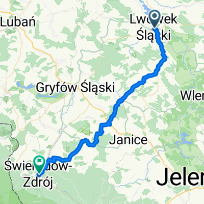
A cycling route starting in Gmina Lwówek Śląski, Lower Silesian Voivodeship, Poland.
Overview
About this route
Saturday: 14th century church under reconstruction, Wleń: castle hill, ruins and palace Pławna: Castle of Silesian Legends Pławna - Lwówek Śląski: bike path
- -:--
- Duration
- 34.1 km
- Distance
- 319 m
- Ascent
- 320 m
- Descent
- ---
- Avg. speed
- ---
- Max. altitude

Route quality
Waytypes & surfaces along the route
Waytypes
Road
15.3 km
(45 %)
Track
3.8 km
(11 %)
Surfaces
Paved
21.1 km
(62 %)
Unpaved
3.1 km
(9 %)
Asphalt
20.8 km
(61 %)
Ground
3.1 km
(9 %)
Continue with Bikemap
Use, edit, or download this cycling route
You would like to ride Sudety 12 or customize it for your own trip? Here is what you can do with this Bikemap route:
Free features
- Save this route as favorite or in collections
- Copy & plan your own version of this route
- Sync your route with Garmin or Wahoo
Premium features
Free trial for 3 days, or one-time payment. More about Bikemap Premium.
- Navigate this route on iOS & Android
- Export a GPX / KML file of this route
- Create your custom printout (try it for free)
- Download this route for offline navigation
Discover more Premium features.
Get Bikemap PremiumFrom our community
Other popular routes starting in Gmina Lwówek Śląski
 Sudety 12
- Distance
- 34.1 km
- Ascent
- 319 m
- Descent
- 320 m
- Location
- Gmina Lwówek Śląski, Lower Silesian Voivodeship, Poland
 Lwówek Śląski - Lubomierz - Wleń - Lwówek Śląski
- Distance
- 46 km
- Ascent
- 472 m
- Descent
- 477 m
- Location
- Gmina Lwówek Śląski, Lower Silesian Voivodeship, Poland
 Untitled route
- Distance
- 39.5 km
- Ascent
- 626 m
- Descent
- 336 m
- Location
- Gmina Lwówek Śląski, Lower Silesian Voivodeship, Poland
 Włodzice Wielkie do Włodzice Wielkie
- Distance
- 32.3 km
- Ascent
- 297 m
- Descent
- 318 m
- Location
- Gmina Lwówek Śląski, Lower Silesian Voivodeship, Poland
 Route to Pilchowice Zapora
- Distance
- 22.7 km
- Ascent
- 438 m
- Descent
- 357 m
- Location
- Gmina Lwówek Śląski, Lower Silesian Voivodeship, Poland
 Trasa z 47A, Rakowice Małe
- Distance
- 27.8 km
- Ascent
- 244 m
- Descent
- 292 m
- Location
- Gmina Lwówek Śląski, Lower Silesian Voivodeship, Poland
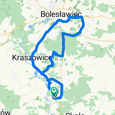
 LBobr_Lwowek_Boleslawiec
- Distance
- 22 km
- Ascent
- 123 m
- Descent
- 143 m
- Location
- Gmina Lwówek Śląski, Lower Silesian Voivodeship, Poland
 Lwówek Śląski-Pielgrzymka
- Distance
- 21.7 km
- Ascent
- 257 m
- Descent
- 257 m
- Location
- Gmina Lwówek Śląski, Lower Silesian Voivodeship, Poland
Open it in the app