

Uppsalasta Tukholmaan
A cycling route starting in Uppsala, Uppsala County, Sweden.
Overview
About this route
- 3 h 31 min
- Duration
- 77.9 km
- Distance
- 661 m
- Ascent
- 659 m
- Descent
- 22.1 km/h
- Avg. speed
- 61 m
- Max. altitude
Route quality
Waytypes & surfaces along the route
Waytypes
Cycleway
49 km
(63 %)
Quiet road
14 km
(18 %)
Surfaces
Paved
57.6 km
(74 %)
Unpaved
7 km
(9 %)
Asphalt
56.8 km
(73 %)
Gravel
6.2 km
(8 %)
Continue with Bikemap
Use, edit, or download this cycling route
You would like to ride Uppsalasta Tukholmaan or customize it for your own trip? Here is what you can do with this Bikemap route:
Free features
- Save this route as favorite or in collections
- Copy & plan your own version of this route
- Sync your route with Garmin or Wahoo
Premium features
Free trial for 3 days, or one-time payment. More about Bikemap Premium.
- Navigate this route on iOS & Android
- Export a GPX / KML file of this route
- Create your custom printout (try it for free)
- Download this route for offline navigation
Discover more Premium features.
Get Bikemap PremiumFrom our community
Other popular routes starting in Uppsala
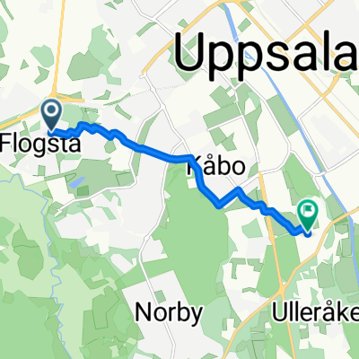 Sernanders väg to Lägerhyddsvägen
- Distance
- 4.9 km
- Ascent
- 34 m
- Descent
- 57 m
- Location
- Uppsala, Uppsala County, Sweden
 De Folkungagatan 21A, Uppsala à Husbyvägen 8–9, Uppsala
- Distance
- 28.6 km
- Ascent
- 44 m
- Descent
- 54 m
- Location
- Uppsala, Uppsala County, Sweden
 Brunnby
- Distance
- 23.1 km
- Ascent
- 153 m
- Descent
- 152 m
- Location
- Uppsala, Uppsala County, Sweden
 Sernanders väg to Lägerhyddsvägen
- Distance
- 4.7 km
- Ascent
- 25 m
- Descent
- 49 m
- Location
- Uppsala, Uppsala County, Sweden
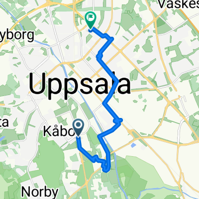
 Sibyllegatan, Uppsala to Sibyllegatan, Uppsala
- Distance
- 16.5 km
- Ascent
- 117 m
- Descent
- 114 m
- Location
- Uppsala, Uppsala County, Sweden
 Sernanders väg to Lägerhyddsvägen
- Distance
- 4.7 km
- Ascent
- 20 m
- Descent
- 52 m
- Location
- Uppsala, Uppsala County, Sweden
 Dag Hammarskjölds Väg to Kantorsgatan
- Distance
- 19.1 km
- Ascent
- 105 m
- Descent
- 131 m
- Location
- Uppsala, Uppsala County, Sweden
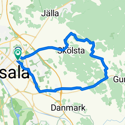
 Funborundan CLONED FROM ROUTE 360147
- Distance
- 46.4 km
- Ascent
- 190 m
- Descent
- 190 m
- Location
- Uppsala, Uppsala County, Sweden
Open it in the app