
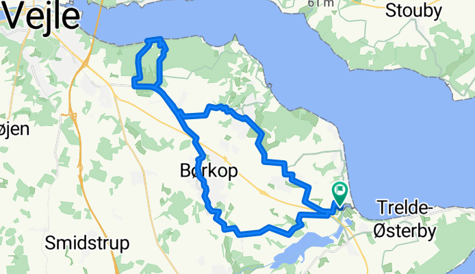
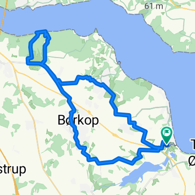
Fjordparken, Børkop to Fjordparken, Børkop
A cycling route starting in Brejning, Region South Denmark, Denmark.
Overview
About this route
- 2 h 1 min
- Duration
- 35.3 km
- Distance
- 305 m
- Ascent
- 305 m
- Descent
- 17.5 km/h
- Avg. speed
- 96 m
- Max. altitude

Route quality
Waytypes & surfaces along the route
Waytypes
Road
15.2 km
(43 %)
Cycleway
10.2 km
(29 %)
Surfaces
Paved
34.3 km
(97 %)
Unpaved
0.7 km
(2 %)
Asphalt
34.3 km
(97 %)
Unpaved (undefined)
0.4 km
(1 %)
Continue with Bikemap
Use, edit, or download this cycling route
You would like to ride Fjordparken, Børkop to Fjordparken, Børkop or customize it for your own trip? Here is what you can do with this Bikemap route:
Free features
- Save this route as favorite or in collections
- Copy & plan your own version of this route
- Sync your route with Garmin or Wahoo
Premium features
Free trial for 3 days, or one-time payment. More about Bikemap Premium.
- Navigate this route on iOS & Android
- Export a GPX / KML file of this route
- Create your custom printout (try it for free)
- Download this route for offline navigation
Discover more Premium features.
Get Bikemap PremiumFrom our community
Other popular routes starting in Brejning
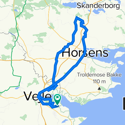
 1. Blans
- Distance
- 106.1 km
- Ascent
- 627 m
- Descent
- 649 m
- Location
- Brejning, Region South Denmark, Denmark
 20230525_BREJNING STRAND HEJLS
- Distance
- 93.4 km
- Ascent
- 763 m
- Descent
- 793 m
- Location
- Brejning, Region South Denmark, Denmark
 Majtur
- Distance
- 114.7 km
- Ascent
- 839 m
- Descent
- 840 m
- Location
- Brejning, Region South Denmark, Denmark
 Fjordparken, Børkop to Fjordparken, Børkop
- Distance
- 35.3 km
- Ascent
- 305 m
- Descent
- 305 m
- Location
- Brejning, Region South Denmark, Denmark
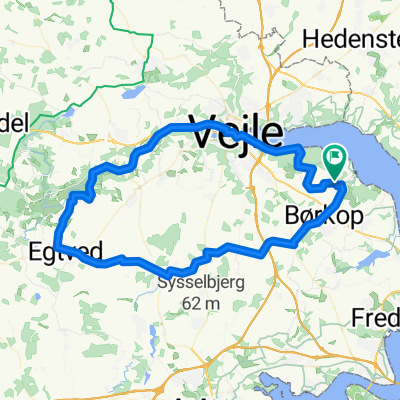 Egtved
- Distance
- 67.6 km
- Ascent
- 200 m
- Descent
- 200 m
- Location
- Brejning, Region South Denmark, Denmark
 Tur til "Gunnars Dødsrute", Bkool
- Distance
- 93 km
- Ascent
- 299 m
- Descent
- 299 m
- Location
- Brejning, Region South Denmark, Denmark
 Mørkholt Camping b. Børkop - Løgismose Camping b. Haarby
- Distance
- 90.3 km
- Ascent
- 251 m
- Descent
- 257 m
- Location
- Brejning, Region South Denmark, Denmark
 1. Domkirke Haderslev
- Distance
- 57.7 km
- Ascent
- 309 m
- Descent
- 317 m
- Location
- Brejning, Region South Denmark, Denmark
Open it in the app