
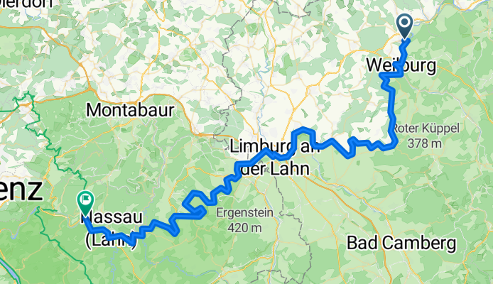
4. Löhnberg-Dausenau
A cycling route starting in Löhnberg, Hesse, Germany.
Overview
About this route
- 5 h 57 min
- Duration
- 86.9 km
- Distance
- 1,297 m
- Ascent
- 1,367 m
- Descent
- 14.6 km/h
- Avg. speed
- 169 m
- Max. altitude

Route quality
Waytypes & surfaces along the route
Waytypes
Track
37.4 km
(43 %)
Path
14.8 km
(17 %)
Surfaces
Paved
76.5 km
(88 %)
Unpaved
5.2 km
(6 %)
Asphalt
72.2 km
(83 %)
Gravel
5.2 km
(6 %)
Continue with Bikemap
Use, edit, or download this cycling route
You would like to ride 4. Löhnberg-Dausenau or customize it for your own trip? Here is what you can do with this Bikemap route:
Free features
- Save this route as favorite or in collections
- Copy & plan your own version of this route
- Split it into stages to create a multi-day tour
- Sync your route with Garmin or Wahoo
Premium features
Free trial for 3 days, or one-time payment. More about Bikemap Premium.
- Navigate this route on iOS & Android
- Export a GPX / KML file of this route
- Create your custom printout (try it for free)
- Download this route for offline navigation
Discover more Premium features.
Get Bikemap PremiumFrom our community
Other popular routes starting in Löhnberg
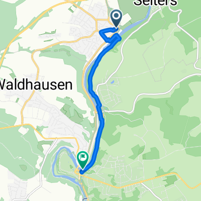
 Wetzlarer Straße 10A nach Burgruine
- Distance
- 9.3 km
- Ascent
- 322 m
- Descent
- 143 m
- Location
- Löhnberg, Hesse, Germany
 Lahnradweg Löhnberg Runkel - familienfreundlich
- Distance
- 31.5 km
- Ascent
- 220 m
- Descent
- 242 m
- Location
- Löhnberg, Hesse, Germany
 Löhnberg Weilburg (Lahnradweg)
- Distance
- 4.5 km
- Ascent
- 14 m
- Descent
- 37 m
- Location
- Löhnberg, Hesse, Germany
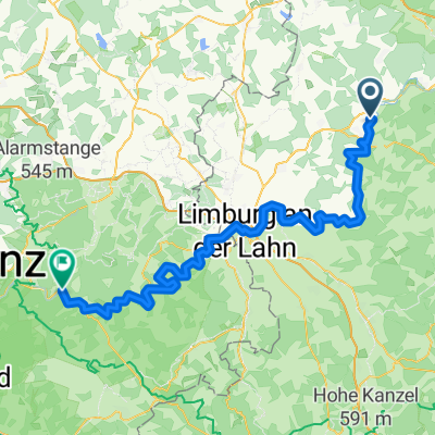
 11.08.02 Löhnberg-Bad Ems (14. Etappe)
- Distance
- 85.9 km
- Ascent
- 423 m
- Descent
- 500 m
- Location
- Löhnberg, Hesse, Germany
 4. Löhnberg-Dausenau
- Distance
- 86.9 km
- Ascent
- 1,297 m
- Descent
- 1,367 m
- Location
- Löhnberg, Hesse, Germany
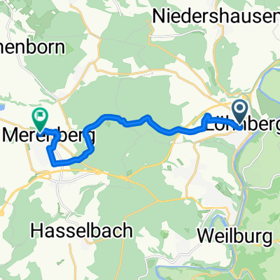
 ED Lbg Tanke nach Merenberg
- Distance
- 10.3 km
- Ascent
- 293 m
- Descent
- 205 m
- Location
- Löhnberg, Hesse, Germany
 Weiltal-Grävenwiesbach-Waldsolms-Braunfels
- Distance
- 78.3 km
- Ascent
- 571 m
- Descent
- 568 m
- Location
- Löhnberg, Hesse, Germany
 3tens: Löhnberg-KallenbachRW-UlmtalRW-Löhnberg stark verkürzte Version
- Distance
- 36 km
- Ascent
- 449 m
- Descent
- 449 m
- Location
- Löhnberg, Hesse, Germany
Open it in the app