
From Alleghe to Val di Zoldo
A cycling route starting in Rocca Pietore, Veneto, Italy.
Overview
About this route
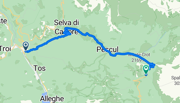
El Passo Staulanza, situado en el corazón de los Dolomitas de Belluno, conecta el valle del Cordevole con el Val di Zoldo, ofreciendo un paso natural entre paisajes de gran belleza y tradición alpina. Desde su cima, a 1773 metros de altitud, se contemplan algunos de los macizos más emblemáticos como el Monte Pelmo, cuya silueta piramidal se alza imponente sobre bosques de coníferas, praderas y pastos de altura. A los pies del puerto se encuentra Caprile, un pequeño y encantador núcleo que conserva la atmósfera típica dolomítica y que sirve como base ideal para múltiples rutas ciclistas, entre ellas, la que conduce a Staulanza. Esta carretera, conocida por su excelente mantenimiento y bajo tráfico, es apreciada tanto por el cicloturismo como por los profesionales del ciclismo, que la han transitado en más de una ocasión durante el Giro de Italia, normalmente como ascensión de paso dentro de etapas de gran fondo.
- 1 h 2 min
- Duration
- 14.5 km
- Distance
- 983 m
- Ascent
- 207 m
- Descent
- 14.1 km/h
- Avg. speed
- 1,778 m
- Max. altitude

Route photos

Route quality
Waytypes & surfaces along the route
Surfaces
Paved
14.4 km
(99 %)
Asphalt
14.4 km
(99 %)
Undefined
0.1 km
(1 %)
Continue with Bikemap
Use, edit, or download this cycling route
You would like to ride From Alleghe to Val di Zoldo or customize it for your own trip? Here is what you can do with this Bikemap route:
Free features
- Save this route as favorite or in collections
- Copy & plan your own version of this route
- Sync your route with Garmin or Wahoo
Premium features
Free trial for 3 days, or one-time payment. More about Bikemap Premium.
- Navigate this route on iOS & Android
- Export a GPX / KML file of this route
- Create your custom printout (try it for free)
- Download this route for offline navigation
Discover more Premium features.
Get Bikemap PremiumFrom our community
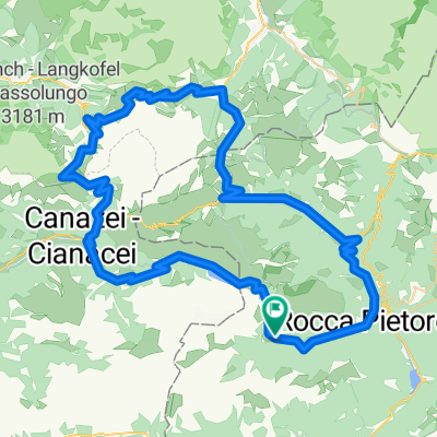
Other popular routes starting in Rocca Pietore
 falzarego,campolongo,pordoi,fedaia
- Distance
- 98 km
- Ascent
- 2,876 m
- Descent
- 2,877 m
- Location
- Rocca Pietore, Veneto, Italy
 Caprile -TRE CIME DI LAVAREDO
- Distance
- 111.2 km
- Ascent
- 3,281 m
- Descent
- 3,275 m
- Location
- Rocca Pietore, Veneto, Italy
 Giro d`Italia 2008 - stage 4
- Distance
- 85.5 km
- Ascent
- 3,088 m
- Descent
- 2,747 m
- Location
- Rocca Pietore, Veneto, Italy
 Caprile rifugio auronzo
- Distance
- 120.9 km
- Ascent
- 3,314 m
- Descent
- 3,314 m
- Location
- Rocca Pietore, Veneto, Italy
 Fedayia, Pordoi
- Distance
- 72.4 km
- Ascent
- 2,370 m
- Descent
- 2,572 m
- Location
- Rocca Pietore, Veneto, Italy
 Caprile to Caprile
- Distance
- 99.5 km
- Ascent
- 2,538 m
- Descent
- 2,536 m
- Location
- Rocca Pietore, Veneto, Italy
 Giro d`Italia 2009 - Stage 3
- Distance
- 88 km
- Ascent
- 2,323 m
- Descent
- 1,936 m
- Location
- Rocca Pietore, Veneto, Italy
 lidl-tour-2015-1-5
- Distance
- 101.9 km
- Ascent
- 2,491 m
- Descent
- 2,484 m
- Location
- Rocca Pietore, Veneto, Italy
Open it in the app