

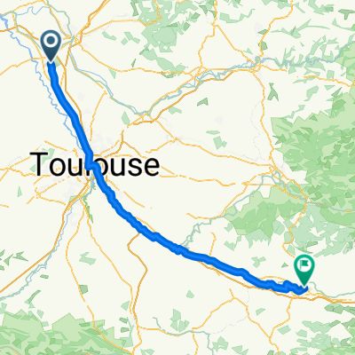
trip 2012 etape 12 montech saint-laurent
A cycling route starting in Montech, Occitanie, France.
Overview
About this route
98 km
camping domaine saint laurent
15 euros
- -:--
- Duration
- 98.1 km
- Distance
- 212 m
- Ascent
- 39 m
- Descent
- ---
- Avg. speed
- ---
- Max. altitude

Route quality
Waytypes & surfaces along the route
Waytypes
Cycleway
47.1 km
(48 %)
Path
39.2 km
(40 %)
Surfaces
Paved
86.3 km
(88 %)
Unpaved
2.9 km
(3 %)
Asphalt
84.4 km
(86 %)
Concrete
2 km
(2 %)
Continue with Bikemap
Use, edit, or download this cycling route
You would like to ride trip 2012 etape 12 montech saint-laurent or customize it for your own trip? Here is what you can do with this Bikemap route:
Free features
- Save this route as favorite or in collections
- Copy & plan your own version of this route
- Split it into stages to create a multi-day tour
- Sync your route with Garmin or Wahoo
Premium features
Free trial for 3 days, or one-time payment. More about Bikemap Premium.
- Navigate this route on iOS & Android
- Export a GPX / KML file of this route
- Create your custom printout (try it for free)
- Download this route for offline navigation
Discover more Premium features.
Get Bikemap PremiumFrom our community
Other popular routes starting in Montech
 escatalens monbeton montech escatalens
- Distance
- 26 km
- Ascent
- 33 m
- Descent
- 32 m
- Location
- Montech, Occitanie, France
 Canal des deux mers 3
- Distance
- 43.8 km
- Ascent
- 44 m
- Descent
- 10 m
- Location
- Montech, Occitanie, France
 trip 2012 etape 12 montech saint-laurent
- Distance
- 98.1 km
- Ascent
- 212 m
- Descent
- 39 m
- Location
- Montech, Occitanie, France
 escatalens castelsarazin escatalens par canal
- Distance
- 25.9 km
- Ascent
- 24 m
- Descent
- 25 m
- Location
- Montech, Occitanie, France
 Day 2 - Montech - Valence d'Agen
- Distance
- 42.1 km
- Ascent
- 29 m
- Descent
- 76 m
- Location
- Montech, Occitanie, France
 escat moissac escat
- Distance
- 43.4 km
- Ascent
- 41 m
- Descent
- 42 m
- Location
- Montech, Occitanie, France
 Montech - Carcassonne
- Distance
- 147.9 km
- Ascent
- 483 m
- Descent
- 488 m
- Location
- Montech, Occitanie, France
 Montech-Deyme Camping des violettes
- Distance
- 63.9 km
- Ascent
- 91 m
- Descent
- 39 m
- Location
- Montech, Occitanie, France
Open it in the app