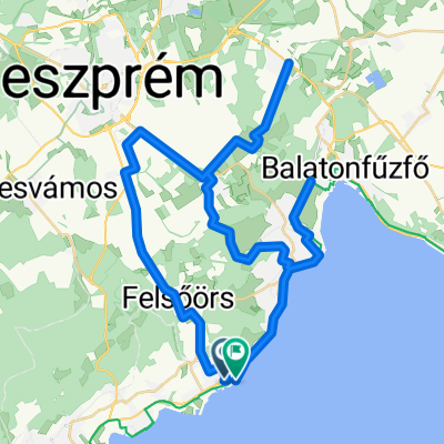


Felsőörs - May János utca
- 19.7 km
- 52 m
- 133 m
- Csopak, Veszprém megye, Hungary
A cycling route starting in Csopak, Veszprém megye, Hungary.
Overview
created this 4 months ago


Route quality
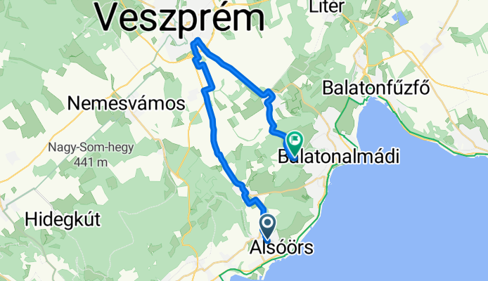
Cycleway
15.3 km
(66 %)
Quiet road
7.7 km
(33 %)
Undefined
0.2 km
(1 %)
Paved
23.2 km
(100 %)
Asphalt
23.2 km
(100 %)
Continue with Bikemap
You would like to ride Útvonal innen: May János utca or customize it for your own trip? Here is what you can do with this Bikemap route:
Free trial for 3 days, or one-time payment. More about Bikemap Premium.
Discover more Premium features.
Get Bikemap PremiumFrom our community
Open it in the app