
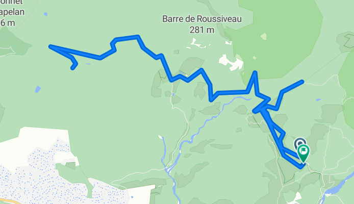
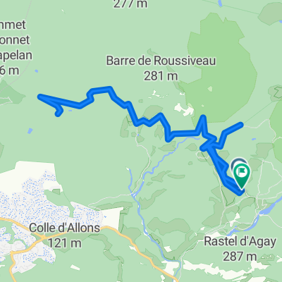
Pont du Gratadis, Saint-Raphaël to Pont du Gratadis, Saint-Raphaël
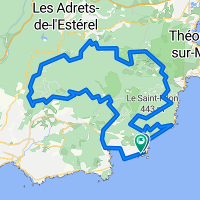
A cycling route starting in Théoule-sur-Mer, Provence-Alpes-Côte d'Azur Region, France.
Overview
About this route
- 1 h 43 min
- Duration
- 17.9 km
- Distance
- 294 m
- Ascent
- 295 m
- Descent
- 10.4 km/h
- Avg. speed
- 132 m
- Max. altitude

Route quality
Waytypes & surfaces along the route
Waytypes
Track
15.4 km
(86 %)
Quiet road
2 km
(11 %)
Path
0.5 km
(3 %)
Surfaces
Paved
5.9 km
(33 %)
Unpaved
11.8 km
(66 %)
Unpaved (undefined)
6.4 km
(36 %)
Asphalt
5.9 km
(33 %)
Continue with Bikemap
Use, edit, or download this cycling route
You would like to ride Pont du Gratadis, Saint-Raphaël to Pont du Gratadis, Saint-Raphaël or customize it for your own trip? Here is what you can do with this Bikemap route:
Free features
- Save this route as favorite or in collections
- Copy & plan your own version of this route
- Sync your route with Garmin or Wahoo
Premium features
Free trial for 3 days, or one-time payment. More about Bikemap Premium.
- Navigate this route on iOS & Android
- Export a GPX / KML file of this route
- Create your custom printout (try it for free)
- Download this route for offline navigation
Discover more Premium features.
Get Bikemap PremiumFrom our community
Other popular routes starting in Théoule-sur-Mer
 La Napoule-Tanneron-Auribeau-Tanneron-les Adrets
- Distance
- 70.7 km
- Ascent
- 1,045 m
- Descent
- 1,043 m
- Location
- Théoule-sur-Mer, Provence-Alpes-Côte d'Azur Region, France
 La California
- Distance
- 17.1 km
- Ascent
- 601 m
- Descent
- 601 m
- Location
- Théoule-sur-Mer, Provence-Alpes-Côte d'Azur Region, France
 Boulevard des Lucioles, Saint-Raphaël to Boulevard des Lucioles, Saint-Raphaël
- Distance
- 58.9 km
- Ascent
- 1,142 m
- Descent
- 1,139 m
- Location
- Théoule-sur-Mer, Provence-Alpes-Côte d'Azur Region, France
 Pont du Gratadis, Saint-Raphaël to Pont du Gratadis, Saint-Raphaël
- Distance
- 17.9 km
- Ascent
- 294 m
- Descent
- 295 m
- Location
- Théoule-sur-Mer, Provence-Alpes-Côte d'Azur Region, France
 Grasse
- Distance
- 97.1 km
- Ascent
- 1,024 m
- Descent
- 1,024 m
- Location
- Théoule-sur-Mer, Provence-Alpes-Côte d'Azur Region, France
 MPL TO Nice
- Distance
- 50.7 km
- Ascent
- 570 m
- Descent
- 542 m
- Location
- Théoule-sur-Mer, Provence-Alpes-Côte d'Azur Region, France
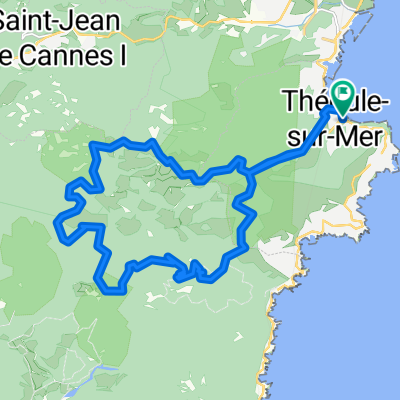 Tour de l'Ours
- Distance
- 25.2 km
- Ascent
- 911 m
- Descent
- 911 m
- Location
- Théoule-sur-Mer, Provence-Alpes-Côte d'Azur Region, France
 06 W Theoule Monge Razor SP3 SP2 Bul SP1 V2 20K
- Distance
- 19.3 km
- Ascent
- 659 m
- Descent
- 659 m
- Location
- Théoule-sur-Mer, Provence-Alpes-Côte d'Azur Region, France
Open it in the app