
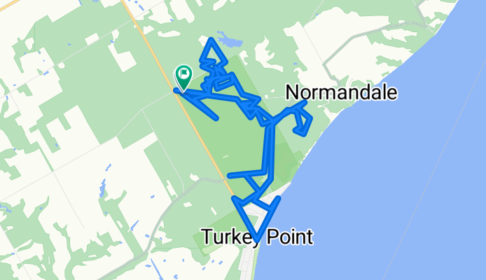
42.712, -80.346 to 42.712, -80.346
A cycling route starting in Norfolk County, Ontario, Canada.
Overview
About this route
- 4 h 22 min
- Duration
- 30.7 km
- Distance
- 517 m
- Ascent
- 559 m
- Descent
- 7 km/h
- Avg. speed
- 263 m
- Max. altitude
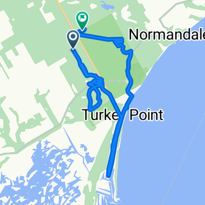
Route photos


Continue with Bikemap
Use, edit, or download this cycling route
You would like to ride 42.712, -80.346 to 42.712, -80.346 or customize it for your own trip? Here is what you can do with this Bikemap route:
Free features
- Save this route as favorite or in collections
- Copy & plan your own version of this route
- Sync your route with Garmin or Wahoo
Premium features
Free trial for 3 days, or one-time payment. More about Bikemap Premium.
- Navigate this route on iOS & Android
- Export a GPX / KML file of this route
- Create your custom printout (try it for free)
- Download this route for offline navigation
Discover more Premium features.
Get Bikemap PremiumFrom our community
Other popular routes starting in Norfolk County
 Antique Tour
- Distance
- 51.5 km
- Ascent
- 94 m
- Descent
- 94 m
- Location
- Norfolk County, Ontario, Canada
 Heart of Windham Tour
- Distance
- 40.3 km
- Ascent
- 81 m
- Descent
- 84 m
- Location
- Norfolk County, Ontario, Canada
 Norfolk County to Road 10, Norfolk County
- Distance
- 16.6 km
- Ascent
- 212 m
- Descent
- 215 m
- Location
- Norfolk County, Ontario, Canada
 Waterford to Maple grove Concession 8 Townsend 317, St. Williams to Concession 8 Townsend 317, St. Williams
- Distance
- 29.2 km
- Ascent
- 70 m
- Descent
- 34 m
- Location
- Norfolk County, Ontario, Canada
 From Port Dover to Waterford
- Distance
- 23 km
- Ascent
- 88 m
- Descent
- 26 m
- Location
- Norfolk County, Ontario, Canada
 Ports of Lake Erie - Day 3 (Port Dover to Port Burwell)
- Distance
- 68.6 km
- Ascent
- 284 m
- Descent
- 270 m
- Location
- Norfolk County, Ontario, Canada
 Carolinian Tour
- Distance
- 75.9 km
- Ascent
- 107 m
- Descent
- 107 m
- Location
- Norfolk County, Ontario, Canada
 Port Town Tour
- Distance
- 57.4 km
- Ascent
- 187 m
- Descent
- 187 m
- Location
- Norfolk County, Ontario, Canada
Open it in the app