

12-MTB-S-Grunewald-3
A cycling route starting in Grunewald, State of Berlin, Germany.
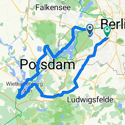
Overview
About this route
Überwiegend kleine Pfade, hoch und runter. Zum Schluß auf breiterem Forstweg zurück zum S-Bhanhof Grunewlad. Ca. 1,5 Std, Fahrzeit.
- -:--
- Duration
- 19 km
- Distance
- 216 m
- Ascent
- 216 m
- Descent
- ---
- Avg. speed
- ---
- Max. altitude
Route quality
Waytypes & surfaces along the route
Waytypes
Track
12.5 km
(66 %)
Path
5.5 km
(29 %)
Surfaces
Paved
0.6 km
(3 %)
Unpaved
18.2 km
(96 %)
Ground
10.5 km
(56 %)
Gravel
7.7 km
(41 %)
Continue with Bikemap
Use, edit, or download this cycling route
You would like to ride 12-MTB-S-Grunewald-3 or customize it for your own trip? Here is what you can do with this Bikemap route:
Free features
- Save this route as favorite or in collections
- Copy & plan your own version of this route
- Sync your route with Garmin or Wahoo
Premium features
Free trial for 3 days, or one-time payment. More about Bikemap Premium.
- Navigate this route on iOS & Android
- Export a GPX / KML file of this route
- Create your custom printout (try it for free)
- Download this route for offline navigation
Discover more Premium features.
Get Bikemap PremiumFrom our community
Other popular routes starting in Grunewald
 Spandau, Sacrow, Schwielowsee, Caputh, Schenkenhorst
- Distance
- 94.7 km
- Ascent
- 390 m
- Descent
- 395 m
- Location
- Grunewald, State of Berlin, Germany
 Havelrunde
- Distance
- 20.9 km
- Ascent
- 103 m
- Descent
- 107 m
- Location
- Grunewald, State of Berlin, Germany
 Schwielowsee-Feierabendrunde
- Distance
- 83.8 km
- Ascent
- 349 m
- Descent
- 346 m
- Location
- Grunewald, State of Berlin, Germany
 Havelrunde
- Distance
- 57.8 km
- Ascent
- 399 m
- Descent
- 395 m
- Location
- Grunewald, State of Berlin, Germany
 S Grunewald, Caputh, Schenkenhorst, S Grunewald (ohne Havelchaussee)
- Distance
- 76.8 km
- Ascent
- 320 m
- Descent
- 318 m
- Location
- Grunewald, State of Berlin, Germany
 Drei Berge bei Potsdam
- Distance
- 82.4 km
- Ascent
- 305 m
- Descent
- 309 m
- Location
- Grunewald, State of Berlin, Germany
 Schwielowsee-Feierabendrunde finalisiert
- Distance
- 89.9 km
- Ascent
- 303 m
- Descent
- 303 m
- Location
- Grunewald, State of Berlin, Germany
 RTF Havel-Frühlingsrunde 2 Pkt.
- Distance
- 80.2 km
- Ascent
- 373 m
- Descent
- 378 m
- Location
- Grunewald, State of Berlin, Germany
Open it in the app