
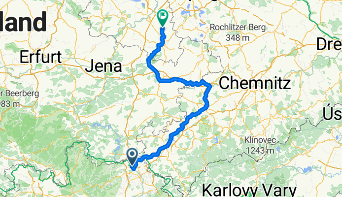
Overview
About this route
- 10 h 58 min
- Duration
- 183.2 km
- Distance
- 1,608 m
- Ascent
- 1,897 m
- Descent
- 16.7 km/h
- Avg. speed
- 598 m
- Max. altitude

Part of
Bikepacking-Tour 2025
15 stages
Route quality
Waytypes & surfaces along the route
Waytypes
Quiet road
67.8 km
(37 %)
Path
34.8 km
(19 %)
Surfaces
Paved
124.6 km
(68 %)
Unpaved
14.7 km
(8 %)
Asphalt
115.4 km
(63 %)
Paved (undefined)
7.3 km
(4 %)
Continue with Bikemap
Use, edit, or download this cycling route
You would like to ride Lichtenberg - Gera or customize it for your own trip? Here is what you can do with this Bikemap route:
Free features
- Save this route as favorite or in collections
- Copy & plan your own version of this route
- Split it into stages to create a multi-day tour
- Sync your route with Garmin or Wahoo
Premium features
Free trial for 3 days, or one-time payment. More about Bikemap Premium.
- Navigate this route on iOS & Android
- Export a GPX / KML file of this route
- Create your custom printout (try it for free)
- Download this route for offline navigation
Discover more Premium features.
Get Bikemap PremiumFrom our community
Other popular routes starting in Töpen
 Saale 2 (Hirschberg-Ziegenrück)
- Distance
- 65.8 km
- Ascent
- 720 m
- Descent
- 839 m
- Location
- Töpen, Bavaria, Germany
 Hirschberg to Schleiz to Auma to Gera
- Distance
- 102.4 km
- Ascent
- 457 m
- Descent
- 759 m
- Location
- Töpen, Bavaria, Germany
 Saale 7 kurz: Hirschberg - Ziegenrück Hotel Am Schloßberg, 61km, 654hm
- Distance
- 61 km
- Ascent
- 654 m
- Descent
- 819 m
- Location
- Töpen, Bavaria, Germany
 Grenztour, Mödlareuth
- Distance
- 55.5 km
- Ascent
- 530 m
- Descent
- 530 m
- Location
- Töpen, Bavaria, Germany
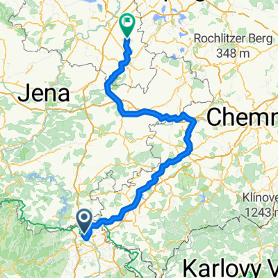 Lichtenberg - Gera
- Distance
- 183.2 km
- Ascent
- 1,608 m
- Descent
- 1,897 m
- Location
- Töpen, Bavaria, Germany
 Hof-Mödlareuth
- Distance
- 12.2 km
- Ascent
- 168 m
- Descent
- 210 m
- Location
- Töpen, Bavaria, Germany
 Mödlareuth
- Distance
- 38.4 km
- Ascent
- 419 m
- Descent
- 488 m
- Location
- Töpen, Bavaria, Germany
 Saale Radtour 2007 - Tag 1
- Distance
- 56.5 km
- Ascent
- 891 m
- Descent
- 922 m
- Location
- Töpen, Bavaria, Germany
Open it in the app