

con - rel
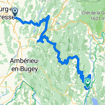
A cycling route starting in Montagnat, Auvergne-Rhône-Alpes, France.
Overview
About this route
- -:--
- Duration
- 48.5 km
- Distance
- 895 m
- Ascent
- 897 m
- Descent
- ---
- Avg. speed
- ---
- Max. altitude
Route quality
Waytypes & surfaces along the route
Waytypes
Road
18.9 km
(39 %)
Quiet road
7.8 km
(16 %)
Surfaces
Paved
24.7 km
(51 %)
Asphalt
24.7 km
(51 %)
Undefined
23.8 km
(49 %)
Continue with Bikemap
Use, edit, or download this cycling route
You would like to ride con - rel or customize it for your own trip? Here is what you can do with this Bikemap route:
Free features
- Save this route as favorite or in collections
- Copy & plan your own version of this route
- Sync your route with Garmin or Wahoo
Premium features
Free trial for 3 days, or one-time payment. More about Bikemap Premium.
- Navigate this route on iOS & Android
- Export a GPX / KML file of this route
- Create your custom printout (try it for free)
- Download this route for offline navigation
Discover more Premium features.
Get Bikemap PremiumFrom our community
Other popular routes starting in Montagnat
 Itinéraire à partir de 7 Rue de Franche-Comté, Bourg-en-Bresse
- Distance
- 8.5 km
- Ascent
- 42 m
- Descent
- 38 m
- Location
- Montagnat, Auvergne-Rhône-Alpes, France
 De 5 Rue de Franche-Comté, Bourg-en-Bresse à 2A Route de Montagnat, Tossiat
- Distance
- 8.3 km
- Ascent
- 63 m
- Descent
- 43 m
- Location
- Montagnat, Auvergne-Rhône-Alpes, France
 De 30 Allée de la Chagne, Saint-Just à 16bis Rue des Dîmes, Bourg-en-Bresse
- Distance
- 3.6 km
- Ascent
- 3 m
- Descent
- 29 m
- Location
- Montagnat, Auvergne-Rhône-Alpes, France
 5 Rue de Franche-Comté, Bourg-en-Bresse à 21 Rue d'Auvergne, Bourg-en-Bresse
- Distance
- 32.5 km
- Ascent
- 436 m
- Descent
- 436 m
- Location
- Montagnat, Auvergne-Rhône-Alpes, France
 Stage 7 Women's tour
- Distance
- 163.9 km
- Ascent
- 2,632 m
- Descent
- 2,602 m
- Location
- Montagnat, Auvergne-Rhône-Alpes, France
 montagnat - cluny
- Distance
- 72.2 km
- Ascent
- 390 m
- Descent
- 404 m
- Location
- Montagnat, Auvergne-Rhône-Alpes, France
 Route du Revermont, Montagnat à 1 Impasse du Lycée, Bourg-en-Bresse
- Distance
- 17.1 km
- Ascent
- 456 m
- Descent
- 475 m
- Location
- Montagnat, Auvergne-Rhône-Alpes, France
 Etapa 15
- Distance
- 159.6 km
- Ascent
- 3,513 m
- Descent
- 3,533 m
- Location
- Montagnat, Auvergne-Rhône-Alpes, France
Open it in the app