
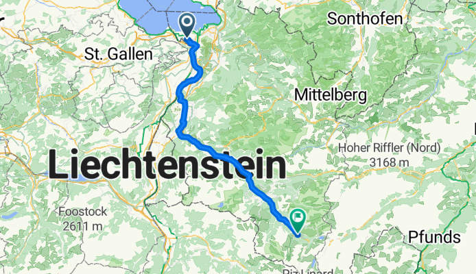
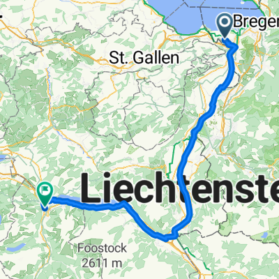
Höchst - Gaschurn
A cycling route starting in Höchst, Vorarlberg, Austria.
Overview
About this route
- 4 h 59 min
- Duration
- 87.4 km
- Distance
- 1,109 m
- Ascent
- 521 m
- Descent
- 17.5 km/h
- Avg. speed
- 988 m
- Max. altitude

Route quality
Waytypes & surfaces along the route
Waytypes
Path
35.8 km
(41 %)
Quiet road
21 km
(24 %)
Surfaces
Paved
85.6 km
(98 %)
Unpaved
0.9 km
(1 %)
Asphalt
85.6 km
(98 %)
Gravel
0.9 km
(1 %)
Undefined
0.9 km
(1 %)
Continue with Bikemap
Use, edit, or download this cycling route
You would like to ride Höchst - Gaschurn or customize it for your own trip? Here is what you can do with this Bikemap route:
Free features
- Save this route as favorite or in collections
- Copy & plan your own version of this route
- Split it into stages to create a multi-day tour
- Sync your route with Garmin or Wahoo
Premium features
Free trial for 3 days, or one-time payment. More about Bikemap Premium.
- Navigate this route on iOS & Android
- Export a GPX / KML file of this route
- Create your custom printout (try it for free)
- Download this route for offline navigation
Discover more Premium features.
Get Bikemap PremiumFrom our community
Other popular routes starting in Höchst
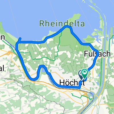
 Höchst Bregenz
- Distance
- 27.9 km
- Ascent
- 62 m
- Descent
- 62 m
- Location
- Höchst, Vorarlberg, Austria
 Neugrütt, Fußach nach Neugrütt, Fußach
- Distance
- 20.1 km
- Ascent
- 31 m
- Descent
- 33 m
- Location
- Höchst, Vorarlberg, Austria
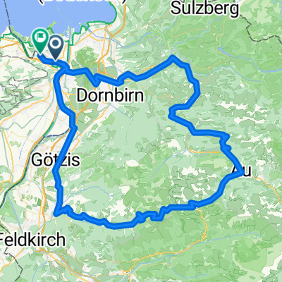 Au Furka Sport 2025
- Distance
- 119 km
- Ascent
- 1,854 m
- Descent
- 1,855 m
- Location
- Höchst, Vorarlberg, Austria
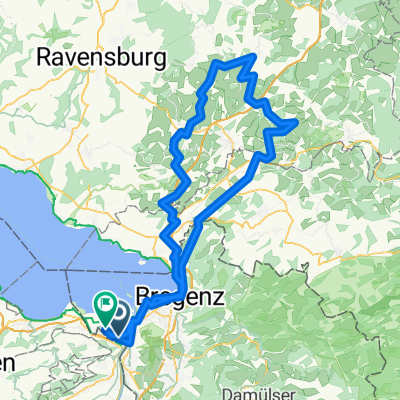
 Lustnau-Pfänder-zurück
- Distance
- 48.1 km
- Ascent
- 711 m
- Descent
- 711 m
- Location
- Höchst, Vorarlberg, Austria
 Farny 2025 Sport
- Distance
- 131.9 km
- Ascent
- 877 m
- Descent
- 877 m
- Location
- Höchst, Vorarlberg, Austria
 Oberstaufenrunde (kurze Variante)
- Distance
- 128.2 km
- Ascent
- 2,052 m
- Descent
- 2,049 m
- Location
- Höchst, Vorarlberg, Austria
 Luzisteig 2025 Sport
- Distance
- 129.8 km
- Ascent
- 458 m
- Descent
- 460 m
- Location
- Höchst, Vorarlberg, Austria
 Höchst - Oberurnen
- Distance
- 96.8 km
- Ascent
- 988 m
- Descent
- 959 m
- Location
- Höchst, Vorarlberg, Austria
Open it in the app