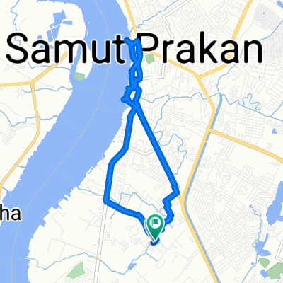
เทศบาลบางปู ซอย 2/6 59/43 to เทศบาลบางปู ซอย 2/6 59/43
A cycling route starting in Mueang Samut Prakan, Samut Prakan, Thailand.
Overview
About this route
- 1 h 46 min
- Duration
- 10.2 km
- Distance
- 181 m
- Ascent
- 149 m
- Descent
- 5.8 km/h
- Avg. speed
- 19 m
- Max. altitude
Continue with Bikemap
Use, edit, or download this cycling route
You would like to ride เทศบาลบางปู ซอย 2/6 59/43 to เทศบาลบางปู ซอย 2/6 59/43 or customize it for your own trip? Here is what you can do with this Bikemap route:
Free features
- Save this route as favorite or in collections
- Copy & plan your own version of this route
- Sync your route with Garmin or Wahoo
Premium features
Free trial for 3 days, or one-time payment. More about Bikemap Premium.
- Navigate this route on iOS & Android
- Export a GPX / KML file of this route
- Create your custom printout (try it for free)
- Download this route for offline navigation
Discover more Premium features.
Get Bikemap PremiumFrom our community
Other popular routes starting in Mueang Samut Prakan
เทศบาลบางปู ซอย 2/6 59/43 to เทศบาลบางปู ซอย 2/8- Distance
- 10.8 km
- Ascent
- 150 m
- Descent
- 129 m
- Location
- Mueang Samut Prakan, Samut Prakan, Thailand
เทศบาลบางปู ซอย 2/6 59/43 to เทศบาลบางปู ซอย 2/6 59/43- Distance
- 10.2 km
- Ascent
- 181 m
- Descent
- 149 m
- Location
- Mueang Samut Prakan, Samut Prakan, Thailand
HJ92+H33, ตำบล ท้ายบ้าน to เทศบาลบางปู ซอย 2/6 59/43, ตำบล ท้ายบ้าน- Distance
- 0.2 km
- Ascent
- 0 m
- Descent
- 0 m
- Location
- Mueang Samut Prakan, Samut Prakan, Thailand
bike tour through Amphoe Mueang Samut Prakan- Distance
- 11.6 km
- Ascent
- 8 m
- Descent
- 9 m
- Location
- Mueang Samut Prakan, Samut Prakan, Thailand
HJ92+H33, ตำบล ท้ายบ้าน to HJ92+H33, ตำบล ท้ายบ้าน- Distance
- 7.8 km
- Ascent
- 72 m
- Descent
- 72 m
- Location
- Mueang Samut Prakan, Samut Prakan, Thailand
finish boat !!- Distance
- 14.2 km
- Ascent
- 10 m
- Descent
- 16 m
- Location
- Mueang Samut Prakan, Samut Prakan, Thailand
Samut Prakan- Distance
- 4.3 km
- Ascent
- 8 m
- Descent
- 8 m
- Location
- Mueang Samut Prakan, Samut Prakan, Thailand
ซอย สุขาภิบาล 33 20/49, ตำบล ท้ายบ้าน to HJ92+H33, ตำบล ท้ายบ้าน- Distance
- 1 km
- Ascent
- 27 m
- Descent
- 27 m
- Location
- Mueang Samut Prakan, Samut Prakan, Thailand
Open it in the app


