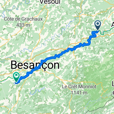
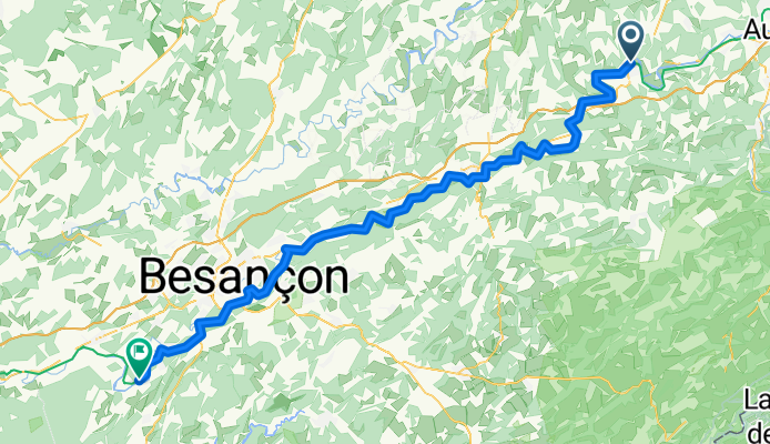
Stein am Rhein - Lyon
Clerval - Boussières
A cycling route starting in Montenois, Bourgogne-Franche-Comté, France.
Overview
About this route
- 5 h 20 min
- Duration
- 87.8 km
- Distance
- 1,066 m
- Ascent
- 1,131 m
- Descent
- 16.5 km/h
- Avg. speed
- 334 m
- Max. altitude
Part of
Stein am Rhein - Lyon
9 stages
Route quality
Waytypes & surfaces along the route
Waytypes
Path
59.7 km
(68 %)
Road
15.8 km
(18 %)
Surfaces
Paved
70.2 km
(80 %)
Unpaved
7.9 km
(9 %)
Asphalt
52.7 km
(60 %)
Paved (undefined)
17.6 km
(20 %)
Continue with Bikemap
Use, edit, or download this cycling route
You would like to ride Clerval - Boussières or customize it for your own trip? Here is what you can do with this Bikemap route:
Free features
- Save this route as favorite or in collections
- Copy & plan your own version of this route
- Split it into stages to create a multi-day tour
- Sync your route with Garmin or Wahoo
Premium features
Free trial for 3 days, or one-time payment. More about Bikemap Premium.
- Navigate this route on iOS & Android
- Export a GPX / KML file of this route
- Create your custom printout (try it for free)
- Download this route for offline navigation
Discover more Premium features.
Get Bikemap PremiumFrom our community
Other popular routes starting in Montenois
projet des clochers juin 2013- Distance
- 95 km
- Ascent
- 583 m
- Descent
- 578 m
- Location
- Montenois, Bourgogne-Franche-Comté, France
I´Isle-sur-le-Doubs (F) - Ranchot (F) 24.08.2007- Distance
- 108.6 km
- Ascent
- 815 m
- Descent
- 869 m
- Location
- Montenois, Bourgogne-Franche-Comté, France
Rue des Lumes 10, L'Isle-sur-le-Doubs nach Impasse de l'Île 1, Ranchot- Distance
- 103.6 km
- Ascent
- 1,130 m
- Descent
- 1,203 m
- Location
- Montenois, Bourgogne-Franche-Comté, France
Luca Lola 1ere partie- Distance
- 34.2 km
- Ascent
- 245 m
- Descent
- 300 m
- Location
- Montenois, Bourgogne-Franche-Comté, France
Montenois - Boussières- Distance
- 88.1 km
- Ascent
- 1,058 m
- Descent
- 1,135 m
- Location
- Montenois, Bourgogne-Franche-Comté, France
266 project part IV- Distance
- 89.9 km
- Ascent
- 675 m
- Descent
- 664 m
- Location
- Montenois, Bourgogne-Franche-Comté, France
24_L'Isle-sur-le-Doubs bis Mulhouse- Distance
- 80.8 km
- Ascent
- 293 m
- Descent
- 341 m
- Location
- Montenois, Bourgogne-Franche-Comté, France
31 - L'ISLE-SUR-LE-DOUBS à MONTBELIARD- Distance
- 25.4 km
- Ascent
- 122 m
- Descent
- 97 m
- Location
- Montenois, Bourgogne-Franche-Comté, France
Open it in the app


