
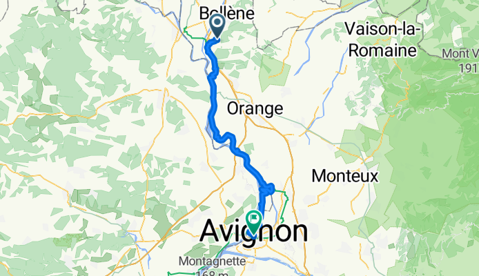
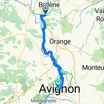
Jonquières-Saint-Vincent - Villeneuve-lès-Maguelone
A cycling route starting in Mondragon, Provence-Alpes-Côte d'Azur Region, France.
Overview
About this route
- 2 h 55 min
- Duration
- 51.5 km
- Distance
- 131 m
- Ascent
- 168 m
- Descent
- 17.7 km/h
- Avg. speed
- 94 m
- Max. altitude

Route quality
Waytypes & surfaces along the route
Waytypes
Path
17.8 km
(35 %)
Quiet road
16.7 km
(32 %)
Surfaces
Paved
44.5 km
(86 %)
Unpaved
0 km
(<1 %)
Asphalt
44.3 km
(86 %)
Metal
0.2 km
(<1 %)
Continue with Bikemap
Use, edit, or download this cycling route
You would like to ride Jonquières-Saint-Vincent - Villeneuve-lès-Maguelone or customize it for your own trip? Here is what you can do with this Bikemap route:
Free features
- Save this route as favorite or in collections
- Copy & plan your own version of this route
- Sync your route with Garmin or Wahoo
Premium features
Free trial for 3 days, or one-time payment. More about Bikemap Premium.
- Navigate this route on iOS & Android
- Export a GPX / KML file of this route
- Create your custom printout (try it for free)
- Download this route for offline navigation
Discover more Premium features.
Get Bikemap PremiumFrom our community
Other popular routes starting in Mondragon
 2º Etapa Velo Rhona
- Distance
- 69.1 km
- Ascent
- 359 m
- Descent
- 353 m
- Location
- Mondragon, Provence-Alpes-Côte d'Azur Region, France
 bollene-vallon
- Distance
- 47.3 km
- Ascent
- 600 m
- Descent
- 548 m
- Location
- Mondragon, Provence-Alpes-Côte d'Azur Region, France
 Chemin de la Maresque nach Chemin de la Barthelasse
- Distance
- 50.8 km
- Ascent
- 108 m
- Descent
- 205 m
- Location
- Mondragon, Provence-Alpes-Côte d'Azur Region, France
 De Bollène la Croisière à Place de la Concorde 4, Bourg-Saint-Andéol
- Distance
- 30.8 km
- Ascent
- 19 m
- Descent
- 10 m
- Location
- Mondragon, Provence-Alpes-Côte d'Azur Region, France
 2004 ツール観戦記 アルプス移動日
- Distance
- 334.9 km
- Ascent
- 2,323 m
- Descent
- 1,212 m
- Location
- Mondragon, Provence-Alpes-Côte d'Azur Region, France
 derboux rochegude les farjons les chevres
- Distance
- 19.6 km
- Ascent
- 223 m
- Descent
- 221 m
- Location
- Mondragon, Provence-Alpes-Côte d'Azur Region, France
 ETAPPE 9 - Mondragon nach Saint-Gilles
- Distance
- 122 km
- Ascent
- 310 m
- Descent
- 349 m
- Location
- Mondragon, Provence-Alpes-Côte d'Azur Region, France
 Mondragon Ventoux
- Distance
- 76 km
- Ascent
- 2,001 m
- Descent
- 188 m
- Location
- Mondragon, Provence-Alpes-Côte d'Azur Region, France
Open it in the app