
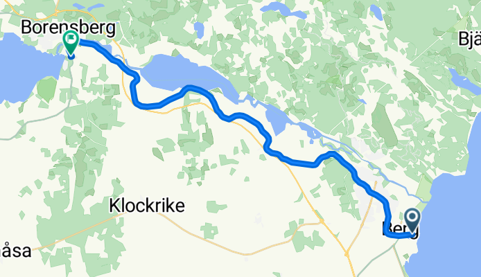
Spantvägen, Vreta Kloster nach Strandbadens campingområde, Borensberg
A cycling route starting in Berg, Östergötland County, Sweden.
Overview
About this route
- 2 h 46 min
- Duration
- 22.3 km
- Distance
- 54 m
- Ascent
- 17 m
- Descent
- 8.1 km/h
- Avg. speed
- 85 m
- Max. altitude
Route photos


Route quality
Waytypes & surfaces along the route
Waytypes
Path
17 km
(76 %)
Track
4 km
(18 %)
Quiet road
1.3 km
(6 %)
Surfaces
Paved
0.9 km
(4 %)
Unpaved
21.4 km
(96 %)
Gravel
21.2 km
(95 %)
Asphalt
0.9 km
(4 %)
Unpaved (undefined)
0.2 km
(1 %)
Continue with Bikemap
Use, edit, or download this cycling route
You would like to ride Spantvägen, Vreta Kloster nach Strandbadens campingområde, Borensberg or customize it for your own trip? Here is what you can do with this Bikemap route:
Free features
- Save this route as favorite or in collections
- Copy & plan your own version of this route
- Sync your route with Garmin or Wahoo
Premium features
Free trial for 3 days, or one-time payment. More about Bikemap Premium.
- Navigate this route on iOS & Android
- Export a GPX / KML file of this route
- Create your custom printout (try it for free)
- Download this route for offline navigation
Discover more Premium features.
Get Bikemap PremiumFrom our community
Other popular routes starting in Berg
 Berg - Rappestad - ToR
- Distance
- 40.7 km
- Ascent
- 140 m
- Descent
- 139 m
- Location
- Berg, Östergötland County, Sweden
 Berg - Rappestad - Maspelösa - Ljung
- Distance
- 47.6 km
- Ascent
- 189 m
- Descent
- 189 m
- Location
- Berg, Östergötland County, Sweden
 Berg--RW Götakanal--Borensberg--Motala Schleuse--Väster (Biskopvagen Aussichtspunkt)--Motala Bahnhof
- Distance
- 51 km
- Ascent
- 230 m
- Descent
- 188 m
- Location
- Berg, Östergötland County, Sweden
- Spantvägen, Vreta Kloster nach Strandbadens campingområde, Borensberg
- Distance
- 22.3 km
- Ascent
- 54 m
- Descent
- 17 m
- Location
- Berg, Östergötland County, Sweden
 18k norrut
- Distance
- 17.9 km
- Ascent
- 239 m
- Descent
- 241 m
- Location
- Berg, Östergötland County, Sweden
 Berg-Ljungsjön-Odensnäs
- Distance
- 33 km
- Ascent
- 177 m
- Descent
- 177 m
- Location
- Berg, Östergötland County, Sweden
 Vånga ToR
- Distance
- 49.8 km
- Ascent
- 391 m
- Descent
- 398 m
- Location
- Berg, Östergötland County, Sweden
 Tjällmo ToR
- Distance
- 73.8 km
- Ascent
- 245 m
- Descent
- 239 m
- Location
- Berg, Östergötland County, Sweden
Open it in the app