
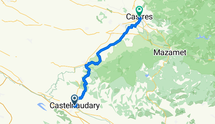
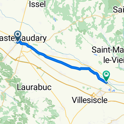
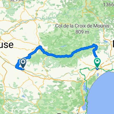
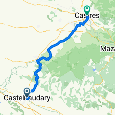
Castelnaudary - Lautrec
A cycling route starting in Castelnaudary, Occitanie, France.
Overview
About this route
- 3 h 26 min
- Duration
- 55.8 km
- Distance
- 869 m
- Ascent
- 876 m
- Descent
- 16.2 km/h
- Avg. speed
- 469 m
- Max. altitude
Route quality
Waytypes & surfaces along the route
Waytypes
Quiet road
33.5 km
(60 %)
Road
12.8 km
(23 %)
Surfaces
Paved
13.9 km
(25 %)
Unpaved
3.9 km
(7 %)
Asphalt
13.4 km
(24 %)
Gravel
3.3 km
(6 %)
Continue with Bikemap
Use, edit, or download this cycling route
You would like to ride Castelnaudary - Lautrec or customize it for your own trip? Here is what you can do with this Bikemap route:
Free features
- Save this route as favorite or in collections
- Copy & plan your own version of this route
- Sync your route with Garmin or Wahoo
Premium features
Free trial for 3 days, or one-time payment. More about Bikemap Premium.
- Navigate this route on iOS & Android
- Export a GPX / KML file of this route
- Create your custom printout (try it for free)
- Download this route for offline navigation
Discover more Premium features.
Get Bikemap PremiumFrom our community
Other popular routes starting in Castelnaudary
 Castelnaudary / Bram
- Distance
- 16.7 km
- Ascent
- 3 m
- Descent
- 50 m
- Location
- Castelnaudary, Occitanie, France
 From Castelnaudary to Béziers
- Distance
- 222.8 km
- Ascent
- 2,457 m
- Descent
- 2,615 m
- Location
- Castelnaudary, Occitanie, France
 castlenaudary - carcassonne
- Distance
- 38.1 km
- Ascent
- 46 m
- Descent
- 86 m
- Location
- Castelnaudary, Occitanie, France
 11.10.25 Castelnaudary Bram Carcassonne
- Distance
- 51.5 km
- Ascent
- 103 m
- Descent
- 203 m
- Location
- Castelnaudary, Occitanie, France
 Castelnaudary to Carcassonne
- Distance
- 45.1 km
- Ascent
- 298 m
- Descent
- 340 m
- Location
- Castelnaudary, Occitanie, France
 canal j5
- Distance
- 68.6 km
- Ascent
- 59 m
- Descent
- 116 m
- Location
- Castelnaudary, Occitanie, France
 Castelnaudary - Lautrec
- Distance
- 55.8 km
- Ascent
- 869 m
- Descent
- 876 m
- Location
- Castelnaudary, Occitanie, France
 Test
Test- Distance
- 12.7 km
- Ascent
- 16 m
- Descent
- 55 m
- Location
- Castelnaudary, Occitanie, France
Open it in the app