
Calais - Nice
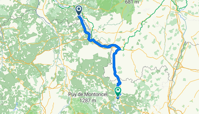
Lucenay-lès-Aix - Le Coteau
A cycling route starting in Lucenay-lès-Aix, Bourgogne-Franche-Comté, France.
Overview
About this route
- 7 h 26 min
- Duration
- 125.9 km
- Distance
- 288 m
- Ascent
- 214 m
- Descent
- 16.9 km/h
- Avg. speed
- 278 m
- Max. altitude
Part of
Calais - Nice
15 stages
Route quality
Waytypes & surfaces along the route
Waytypes
Path
85.6 km
(68 %)
Quiet road
18.9 km
(15 %)
Surfaces
Paved
89.4 km
(71 %)
Unpaved
1.3 km
(1 %)
Asphalt
84.4 km
(67 %)
Paved (undefined)
5 km
(4 %)
Continue with Bikemap
Use, edit, or download this cycling route
You would like to ride Lucenay-lès-Aix - Le Coteau or customize it for your own trip? Here is what you can do with this Bikemap route:
Free features
- Save this route as favorite or in collections
- Copy & plan your own version of this route
- Split it into stages to create a multi-day tour
- Sync your route with Garmin or Wahoo
Premium features
Free trial for 3 days, or one-time payment. More about Bikemap Premium.
- Navigate this route on iOS & Android
- Export a GPX / KML file of this route
- Create your custom printout (try it for free)
- Download this route for offline navigation
Discover more Premium features.
Get Bikemap PremiumFrom our community
Other popular routes starting in Lucenay-lès-Aix
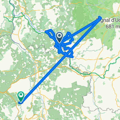 Frankrijk 2
- Distance
- 209.5 km
- Ascent
- 87 m
- Descent
- 87 m
- Location
- Lucenay-lès-Aix, Bourgogne-Franche-Comté, France
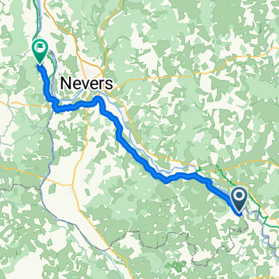
 De Chemin des Terriens 6, Gannay-sur-Loire à Rue de la Jonction 3B, Nevers
- Distance
- 54.9 km
- Ascent
- 137 m
- Descent
- 165 m
- Location
- Lucenay-lès-Aix, Bourgogne-Franche-Comté, France
 Etape 15: Gannay-sur-Loire - Digoin
- Distance
- 57.2 km
- Ascent
- 119 m
- Descent
- 95 m
- Location
- Lucenay-lès-Aix, Bourgogne-Franche-Comté, France
 Lucenay-lès-Aix - Fourchambault
- Distance
- 66.5 km
- Ascent
- 100 m
- Descent
- 127 m
- Location
- Lucenay-lès-Aix, Bourgogne-Franche-Comté, France
 De 332 Les Senaults, Lucenay-lès-Aix à 332 Les Senaults, Lucenay-lès-Aix
- Distance
- 0.7 km
- Ascent
- 0 m
- Descent
- 3 m
- Location
- Lucenay-lès-Aix, Bourgogne-Franche-Comté, France
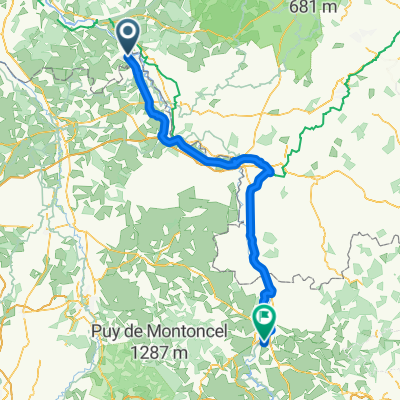 Lucenay-lès-Aix - Le Coteau
- Distance
- 125.9 km
- Ascent
- 288 m
- Descent
- 214 m
- Location
- Lucenay-lès-Aix, Bourgogne-Franche-Comté, France
 Never to Basel 2nd leg
- Distance
- 67.8 km
- Ascent
- 254 m
- Descent
- 204 m
- Location
- Lucenay-lès-Aix, Bourgogne-Franche-Comté, France
 10) Gannay/Loire - Paray le Monial
- Distance
- 61 km
- Ascent
- 89 m
- Descent
- 50 m
- Location
- Lucenay-lès-Aix, Bourgogne-Franche-Comté, France
Open it in the app