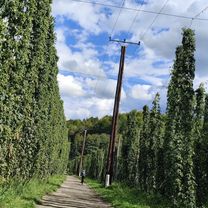
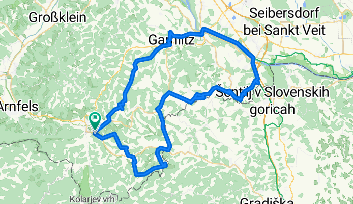
Weinstraßenausfahrt-Südsteirische Weinstraße
A cycling route starting in Leutschach, Styria, Austria.
Overview
About this route
- 3 h 40 min
- Duration
- 52.8 km
- Distance
- 1,375 m
- Ascent
- 1,377 m
- Descent
- 14.4 km/h
- Avg. speed
- 555 m
- Max. altitude
Route quality
Waytypes & surfaces along the route
Waytypes
Quiet road
18.2 km
(35 %)
Road
0.5 km
(<1 %)
Surfaces
Paved
6.9 km
(13 %)
Asphalt
6.9 km
(13 %)
Undefined
45.9 km
(87 %)
Continue with Bikemap
Use, edit, or download this cycling route
You would like to ride Weinstraßenausfahrt-Südsteirische Weinstraße or customize it for your own trip? Here is what you can do with this Bikemap route:
Free features
- Save this route as favorite or in collections
- Copy & plan your own version of this route
- Sync your route with Garmin or Wahoo
Premium features
Free trial for 3 days, or one-time payment. More about Bikemap Premium.
- Navigate this route on iOS & Android
- Export a GPX / KML file of this route
- Create your custom printout (try it for free)
- Download this route for offline navigation
Discover more Premium features.
Get Bikemap PremiumFrom our community
Other popular routes starting in Leutschach
- Weinstraßenausfahrt-Südsteirische Weinstraße
- Distance
- 52.8 km
- Ascent
- 1,375 m
- Descent
- 1,377 m
- Location
- Leutschach, Styria, Austria
- Leutschach Runde
- Distance
- 37.1 km
- Ascent
- 746 m
- Descent
- 801 m
- Location
- Leutschach, Styria, Austria
- Weinstraßenausfahrt - Panoramaradweg-Südsteirische Weinstraße
- Distance
- 49.3 km
- Ascent
- 1,103 m
- Descent
- 1,103 m
- Location
- Leutschach, Styria, Austria
- Weinstraßenausfahrt - Panoramaradweg-Südsteirische Weinstraße
- Distance
- 49.4 km
- Ascent
- 1,018 m
- Descent
- 1,021 m
- Location
- Leutschach, Styria, Austria
- Vogljager Nordausfahrt - Vogljager Nordausfahrt
- Distance
- 35.4 km
- Ascent
- 1,287 m
- Descent
- 1,283 m
- Location
- Leutschach, Styria, Austria
- Remschnigg
- Distance
- 18.2 km
- Ascent
- 466 m
- Descent
- 464 m
- Location
- Leutschach, Styria, Austria
- Leutschach-Seggautal
- Distance
- 39.7 km
- Ascent
- 892 m
- Descent
- 892 m
- Location
- Leutschach, Styria, Austria
- Leutschach - Weinstraße - Route 1
- Distance
- 35.5 km
- Ascent
- 681 m
- Descent
- 684 m
- Location
- Leutschach, Styria, Austria
Open it in the app