
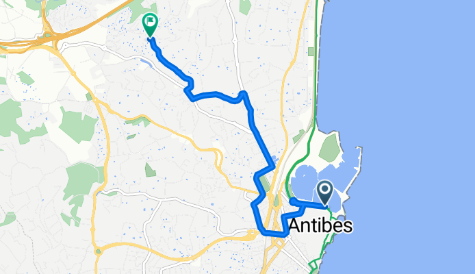
Route in Antibes
A cycling route starting in Antibes, Provence-Alpes-Côte d'Azur Region, France.
Overview
About this route
- 21 min
- Duration
- 5.9 km
- Distance
- 117 m
- Ascent
- 34 m
- Descent
- 16.7 km/h
- Avg. speed
- 96 m
- Max. altitude

Route quality
Waytypes & surfaces along the route
Waytypes
Quiet road
3.1 km
(52 %)
Road
2 km
(34 %)
Surfaces
Paved
5.7 km
(97 %)
Asphalt
5.7 km
(97 %)
Undefined
0.2 km
(3 %)
Continue with Bikemap
Use, edit, or download this cycling route
You would like to ride Route in Antibes or customize it for your own trip? Here is what you can do with this Bikemap route:
Free features
- Save this route as favorite or in collections
- Copy & plan your own version of this route
- Sync your route with Garmin or Wahoo
Premium features
Free trial for 3 days, or one-time payment. More about Bikemap Premium.
- Navigate this route on iOS & Android
- Export a GPX / KML file of this route
- Create your custom printout (try it for free)
- Download this route for offline navigation
Discover more Premium features.
Get Bikemap PremiumFrom our community
Other popular routes starting in Antibes
 Rock of pain
- Distance
- 43.4 km
- Ascent
- 1,423 m
- Descent
- 1,438 m
- Location
- Antibes, Provence-Alpes-Côte d'Azur Region, France
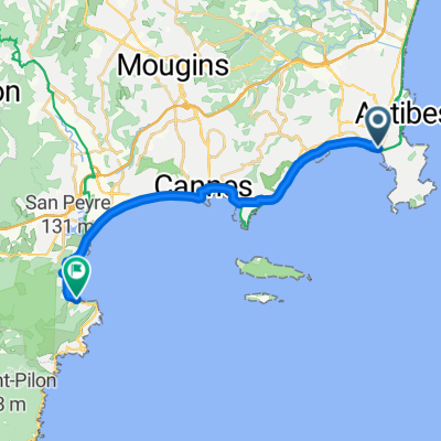
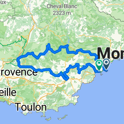 Antibes nach Cannes
- Distance
- 429.7 km
- Ascent
- 10,687 m
- Descent
- 10,728 m
- Location
- Antibes, Provence-Alpes-Côte d'Azur Region, France
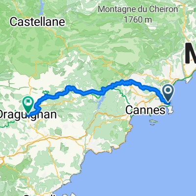 Antibes - Draguignan
- Distance
- 85.7 km
- Ascent
- 2,153 m
- Descent
- 1,941 m
- Location
- Antibes, Provence-Alpes-Côte d'Azur Region, France
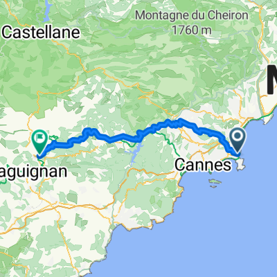 Antibes - Figanières
- Distance
- 77.6 km
- Ascent
- 1,980 m
- Descent
- 1,687 m
- Location
- Antibes, Provence-Alpes-Côte d'Azur Region, France
 Boulevard Édouard Baudoin, Antibes to Boulevard de la Corniche d'Or, Théoule-sur-Mer
- Distance
- 21.1 km
- Ascent
- 315 m
- Descent
- 288 m
- Location
- Antibes, Provence-Alpes-Côte d'Azur Region, France
 Col d'Eze
- Distance
- 66.1 km
- Ascent
- 1,024 m
- Descent
- 1,032 m
- Location
- Antibes, Provence-Alpes-Côte d'Azur Region, France
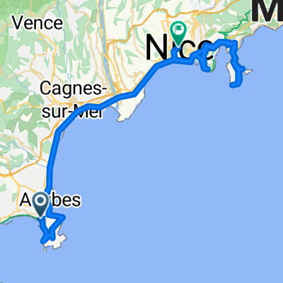 De Antibes a Roquebrune-Cap-Martín
- Distance
- 61.8 km
- Ascent
- 1,260 m
- Descent
- 1,246 m
- Location
- Antibes, Provence-Alpes-Côte d'Azur Region, France
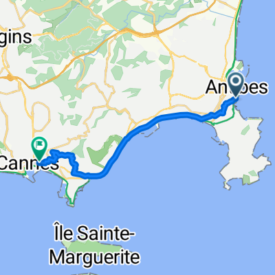 Rue de la Tourraque, Antibes to Place de la Gare, Cannes
- Distance
- 12.9 km
- Ascent
- 134 m
- Descent
- 130 m
- Location
- Antibes, Provence-Alpes-Côte d'Azur Region, France
Open it in the app