
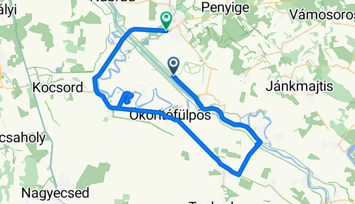
Névtelen Út - Akácfa utca
A cycling route starting in Ököritófülpös, Szabolcs-Szatmár-Bereg, Hungary.
Overview
About this route
- 1 h 52 min
- Duration
- 42.8 km
- Distance
- 153 m
- Ascent
- 194 m
- Descent
- 22.9 km/h
- Avg. speed
- 156 m
- Max. altitude

Route photos


Route quality
Waytypes & surfaces along the route
Waytypes
Cycleway
9.4 km
(22 %)
Access road
9.3 km
(22 %)
Surfaces
Paved
26.5 km
(62 %)
Asphalt
21.6 km
(51 %)
Paving stones
4.9 km
(11 %)
Undefined
16.3 km
(38 %)
Continue with Bikemap
Use, edit, or download this cycling route
You would like to ride Névtelen Út - Akácfa utca or customize it for your own trip? Here is what you can do with this Bikemap route:
Free features
- Save this route as favorite or in collections
- Copy & plan your own version of this route
- Sync your route with Garmin or Wahoo
Premium features
Free trial for 3 days, or one-time payment. More about Bikemap Premium.
- Navigate this route on iOS & Android
- Export a GPX / KML file of this route
- Create your custom printout (try it for free)
- Download this route for offline navigation
Discover more Premium features.
Get Bikemap PremiumFrom our community
Other popular routes starting in Ököritófülpös
 Haza vizen
- Distance
- 359.8 km
- Ascent
- 73 m
- Descent
- 92 m
- Location
- Ököritófülpös, Szabolcs-Szatmár-Bereg, Hungary
 HOLT-SZAMOS kenu túra
- Distance
- 20.2 km
- Ascent
- 4 m
- Descent
- 4 m
- Location
- Ököritófülpös, Szabolcs-Szatmár-Bereg, Hungary
 Recovered Route
- Distance
- 6.1 km
- Ascent
- 0 m
- Descent
- 0 m
- Location
- Ököritófülpös, Szabolcs-Szatmár-Bereg, Hungary
- Névtelen Út - Akácfa utca
- Distance
- 42.8 km
- Ascent
- 153 m
- Descent
- 194 m
- Location
- Ököritófülpös, Szabolcs-Szatmár-Bereg, Hungary
 2.nap to Garbolc
- Distance
- 38.7 km
- Ascent
- 44 m
- Descent
- 39 m
- Location
- Ököritófülpös, Szabolcs-Szatmár-Bereg, Hungary
Open it in the app