
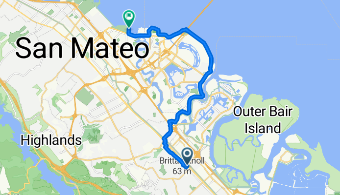
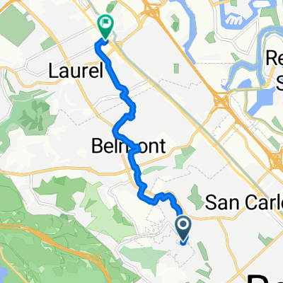
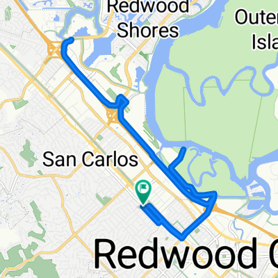
Old County Rd, San Carlos a San Francisco Bay Trail, San Mateo
A cycling route starting in San Carlos, California, United States.
Overview
About this route
- 50 min
- Duration
- 15.3 km
- Distance
- 75 m
- Ascent
- 74 m
- Descent
- 18.4 km/h
- Avg. speed
- 44 m
- Max. altitude
Route photos

Route quality
Waytypes & surfaces along the route
Waytypes
Cycleway
12.7 km
(83 %)
Quiet road
2.3 km
(15 %)
Surfaces
Paved
14.7 km
(96 %)
Asphalt
11.2 km
(73 %)
Paved (undefined)
3.1 km
(20 %)
Continue with Bikemap
Use, edit, or download this cycling route
You would like to ride Old County Rd, San Carlos a San Francisco Bay Trail, San Mateo or customize it for your own trip? Here is what you can do with this Bikemap route:
Free features
- Save this route as favorite or in collections
- Copy & plan your own version of this route
- Sync your route with Garmin or Wahoo
Premium features
Free trial for 3 days, or one-time payment. More about Bikemap Premium.
- Navigate this route on iOS & Android
- Export a GPX / KML file of this route
- Create your custom printout (try it for free)
- Download this route for offline navigation
Discover more Premium features.
Get Bikemap PremiumFrom our community
Other popular routes starting in San Carlos
- Old County Rd, San Carlos a San Francisco Bay Trail, San Mateo
- Distance
- 15.3 km
- Ascent
- 75 m
- Descent
- 74 m
- Location
- San Carlos, California, United States
 Bay Ride
- Distance
- 29.1 km
- Ascent
- 38 m
- Descent
- 38 m
- Location
- San Carlos, California, United States
 From San Carlos to San Mateo
- Distance
- 7.6 km
- Ascent
- 144 m
- Descent
- 217 m
- Location
- San Carlos, California, United States
 Roundtrip San Carlos, Redwood Shores, San Mateo
- Distance
- 25.9 km
- Ascent
- 21 m
- Descent
- 22 m
- Location
- San Carlos, California, United States
 Laurel Street 1438, San Carlos to Laurel Street 1495, San Carlos
- Distance
- 19.3 km
- Ascent
- 7 m
- Descent
- 8 m
- Location
- San Carlos, California, United States
 Mounten View
- Distance
- 46.8 km
- Ascent
- 480 m
- Descent
- 592 m
- Location
- San Carlos, California, United States
 1348 Laurel St, San Carlos to 1348 Laurel St, San Carlos
- Distance
- 28.4 km
- Ascent
- 10 m
- Descent
- 15 m
- Location
- San Carlos, California, United States
 963–995 Skyway Rd, San Carlos to San Francisco Bay Trail, Redwood City
- Distance
- 7.9 km
- Ascent
- 5 m
- Descent
- 5 m
- Location
- San Carlos, California, United States
Open it in the app