
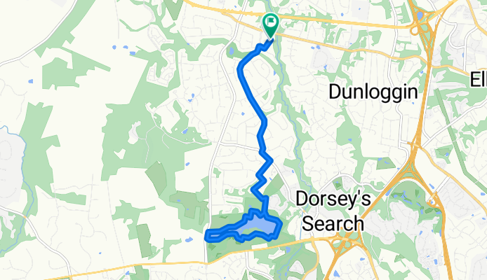
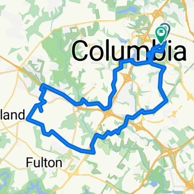
Centennial lake route
A cycling route starting in Columbia, Maryland, United States.
Overview
About this route
- 58 min
- Duration
- 13 km
- Distance
- 133 m
- Ascent
- 135 m
- Descent
- 13.4 km/h
- Avg. speed
- 133 m
- Max. altitude
Route quality
Waytypes & surfaces along the route
Waytypes
Quiet road
7.5 km
(58 %)
Pedestrian area
4.5 km
(35 %)
Surfaces
Paved
9.2 km
(71 %)
Asphalt
9.2 km
(71 %)
Undefined
3.8 km
(29 %)
Continue with Bikemap
Use, edit, or download this cycling route
You would like to ride Centennial lake route or customize it for your own trip? Here is what you can do with this Bikemap route:
Free features
- Save this route as favorite or in collections
- Copy & plan your own version of this route
- Sync your route with Garmin or Wahoo
Premium features
Free trial for 3 days, or one-time payment. More about Bikemap Premium.
- Navigate this route on iOS & Android
- Export a GPX / KML file of this route
- Create your custom printout (try it for free)
- Download this route for offline navigation
Discover more Premium features.
Get Bikemap PremiumFrom our community
Other popular routes starting in Columbia
 Swift Stream Place 10410, Columbia to Columbia Gateway Drive 7121
- Distance
- 9.1 km
- Ascent
- 67 m
- Descent
- 57 m
- Location
- Columbia, Maryland, United States
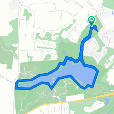
 Centennial 6 mile loop
- Distance
- 8.4 km
- Ascent
- 107 m
- Descent
- 106 m
- Location
- Columbia, Maryland, United States
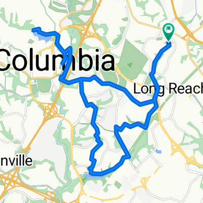 lake tour 2
- Distance
- 25.6 km
- Ascent
- 217 m
- Descent
- 218 m
- Location
- Columbia, Maryland, United States
 Route to 5368 Thunder Hill Road, Columbia, MD 21045
- Distance
- 43 km
- Ascent
- 476 m
- Descent
- 475 m
- Location
- Columbia, Maryland, United States
 9805 Old Annapolis Rd, Ellicott City to 9813 Old Annapolis Rd, Ellicott City
- Distance
- 10 km
- Ascent
- 424 m
- Descent
- 425 m
- Location
- Columbia, Maryland, United States
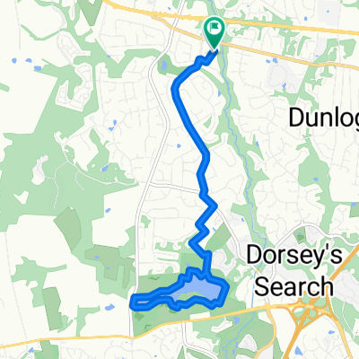 Centennial lake route
- Distance
- 13 km
- Ascent
- 133 m
- Descent
- 135 m
- Location
- Columbia, Maryland, United States
 Thunder Hill Rd, Columbia to Thunder Hill Rd, Columbia
- Distance
- 37.3 km
- Ascent
- 342 m
- Descent
- 340 m
- Location
- Columbia, Maryland, United States
 Day One Western MD Run
- Distance
- 107.6 km
- Ascent
- 684 m
- Descent
- 653 m
- Location
- Columbia, Maryland, United States
Open it in the app