

Col de la Bonette and Col de la Moutière
A cycling route starting in Jausiers, Provence-Alpes-Côte d'Azur Region, France.
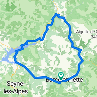
Overview
About this route
All paved excpet 3 kms between Moutiere and Restefond
- -:--
- Duration
- 82.6 km
- Distance
- 2,854 m
- Ascent
- 2,854 m
- Descent
- ---
- Avg. speed
- ---
- Max. altitude

Route quality
Waytypes & surfaces along the route
Waytypes
Busy road
66.7 km
(81 %)
Road
11.7 km
(14 %)
Surfaces
Paved
58.5 km
(71 %)
Unpaved
1.9 km
(2 %)
Asphalt
58.5 km
(71 %)
Gravel
1.9 km
(2 %)
Undefined
22.2 km
(27 %)
Route highlights
Points of interest along the route
Point of interest after 22.1 km
Col de Restefond
Point of interest after 24.1 km
Cime de la Bonette 2802 metres
Point of interest after 24.9 km
Col de la Bonette 2715 metres
Point of interest after 27.9 km
Col de Raspaillon
Point of interest after 59.7 km
Col de la Moutière
Point of interest after 63 km
Faux Col de Restefond
Continue with Bikemap
Use, edit, or download this cycling route
You would like to ride Col de la Bonette and Col de la Moutière or customize it for your own trip? Here is what you can do with this Bikemap route:
Free features
- Save this route as favorite or in collections
- Copy & plan your own version of this route
- Split it into stages to create a multi-day tour
- Sync your route with Garmin or Wahoo
Premium features
Free trial for 3 days, or one-time payment. More about Bikemap Premium.
- Navigate this route on iOS & Android
- Export a GPX / KML file of this route
- Create your custom printout (try it for free)
- Download this route for offline navigation
Discover more Premium features.
Get Bikemap PremiumFrom our community
Other popular routes starting in Jausiers
 Francia Alpok 06 kör
- Distance
- 98.8 km
- Ascent
- 2,659 m
- Descent
- 2,659 m
- Location
- Jausiers, Provence-Alpes-Côte d'Azur Region, France
 Route in La Condamine-Châtelard
- Distance
- 140.2 km
- Ascent
- 5,301 m
- Descent
- 5,303 m
- Location
- Barcelonnette, Provence-Alpes-Côte d'Azur Region, France
 etapa Jausiers 2
- Distance
- 44.4 km
- Ascent
- 927 m
- Descent
- 934 m
- Location
- Jausiers, Provence-Alpes-Côte d'Azur Region, France
 8. Etappe Oberdiessbach Le Lavandou
- Distance
- 46.6 km
- Ascent
- 1,780 m
- Descent
- 1,335 m
- Location
- Jausiers, Provence-Alpes-Côte d'Azur Region, France
 Alpencross 2007/7 - St.Paul bis Valberg
- Distance
- 98.3 km
- Ascent
- 2,556 m
- Descent
- 2,781 m
- Location
- Jausiers, Provence-Alpes-Côte d'Azur Region, France
 okolo Lac de Serre-Poncon + Bonette
- Distance
- 180.9 km
- Ascent
- 2,172 m
- Descent
- 2,172 m
- Location
- Jausiers, Provence-Alpes-Côte d'Azur Region, France
 p25 Col de Vars
- Distance
- 28.1 km
- Ascent
- 690 m
- Descent
- 1,097 m
- Location
- Jausiers, Provence-Alpes-Côte d'Azur Region, France
 RDGA-06 - Jausiers - Jausiers
- Distance
- 85.6 km
- Ascent
- 2,659 m
- Descent
- 2,659 m
- Location
- Jausiers, Provence-Alpes-Côte d'Azur Region, France
Open it in the app