
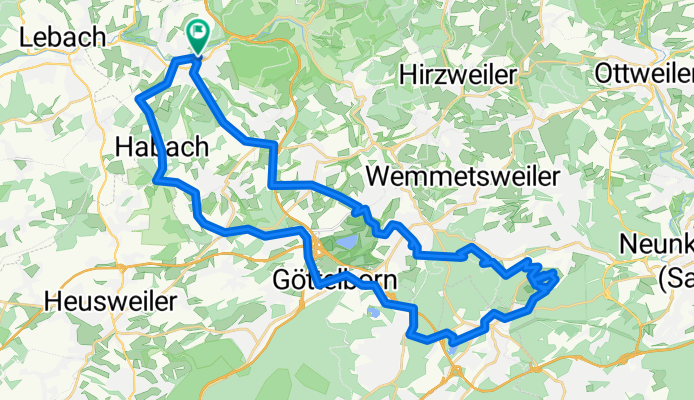
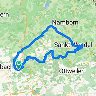
RT 47km Eppelborn-Merchweiler-Itzenplitzer Weier-Halde Reden-Göttelborn-Mangelhausen-Eppelborn-
A cycling route starting in Eppelborn, Saarland, Germany.
Overview
About this route
- 3 h 12 min
- Duration
- 46.3 km
- Distance
- 986 m
- Ascent
- 986 m
- Descent
- 14.4 km/h
- Avg. speed
- 413 m
- Max. altitude

Route quality
Waytypes & surfaces along the route
Waytypes
Quiet road
17.6 km
(38 %)
Track
13 km
(28 %)
Surfaces
Paved
27.3 km
(59 %)
Unpaved
9.7 km
(21 %)
Asphalt
23.6 km
(51 %)
Paved (undefined)
3.7 km
(8 %)
Route highlights
Points of interest along the route
Drinking water after 12.4 km
Restaurant Poseidon
Continue with Bikemap
Use, edit, or download this cycling route
You would like to ride RT 47km Eppelborn-Merchweiler-Itzenplitzer Weier-Halde Reden-Göttelborn-Mangelhausen-Eppelborn- or customize it for your own trip? Here is what you can do with this Bikemap route:
Free features
- Save this route as favorite or in collections
- Copy & plan your own version of this route
- Sync your route with Garmin or Wahoo
Premium features
Free trial for 3 days, or one-time payment. More about Bikemap Premium.
- Navigate this route on iOS & Android
- Export a GPX / KML file of this route
- Create your custom printout (try it for free)
- Download this route for offline navigation
Discover more Premium features.
Get Bikemap PremiumFrom our community
Other popular routes starting in Eppelborn
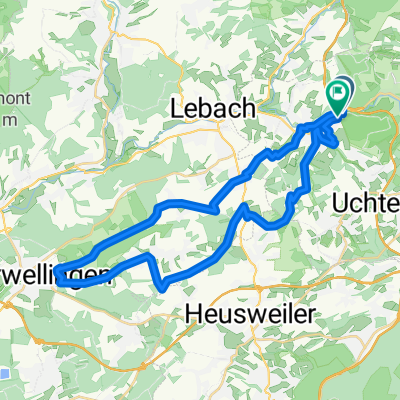
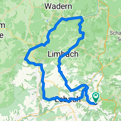 RW 57km Epp- Calmesweiler-Aschb.- Niedersaubach-Limbach-Krettnisch-Bardenb.-Büschf.-Michelb.-Schmelz-Lebach-Aschb.- Calmesweiler-Epp.
- Distance
- 56.3 km
- Ascent
- 884 m
- Descent
- 883 m
- Location
- Eppelborn, Saarland, Germany
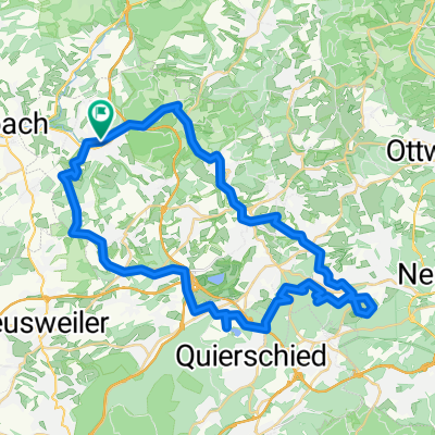 RT 48km ab Eppelborn über Illingen zur "Tour d´ Énergie" und zurück über Mangelhausen
- Distance
- 47.8 km
- Ascent
- 1,001 m
- Descent
- 1,000 m
- Location
- Eppelborn, Saarland, Germany
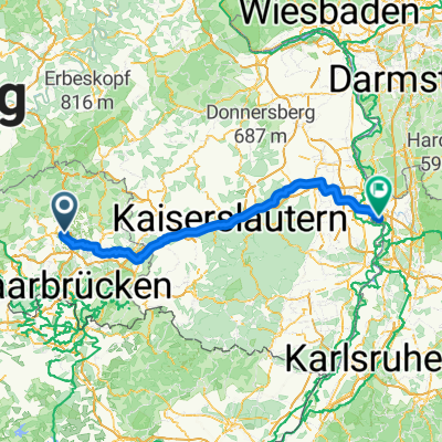 Von Eppelborn bis Mannheim
- Distance
- 149 km
- Ascent
- 1,648 m
- Descent
- 1,824 m
- Location
- Eppelborn, Saarland, Germany
 RT 61km Eppelborn -Berschweile-Rheinstraße-Remmesw.- St. Wendel Misionsh.-Tholey-Oberthal-Aschbach-Eppelborn
- Distance
- 60.6 km
- Ascent
- 1,045 m
- Descent
- 1,045 m
- Location
- Eppelborn, Saarland, Germany
 RT 38km Eppelborn - Resbach - Eppelborn
- Distance
- 37.1 km
- Ascent
- 569 m
- Descent
- 561 m
- Location
- Eppelborn, Saarland, Germany
 Köllertaler Runde, rechtzeitig vorm Gewitter 🚵♂️⛈️
- Distance
- 55.9 km
- Ascent
- 629 m
- Descent
- 630 m
- Location
- Eppelborn, Saarland, Germany
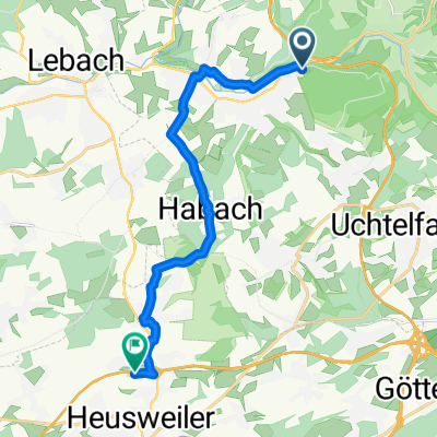 Waldfriedstraße nach Hirteler Straße
- Distance
- 12.9 km
- Ascent
- 210 m
- Descent
- 223 m
- Location
- Eppelborn, Saarland, Germany
 Eppelborn - Landstuhl
- Distance
- 59.7 km
- Ascent
- 810 m
- Descent
- 833 m
- Location
- Eppelborn, Saarland, Germany
Open it in the app