
Szwajcaria 2026
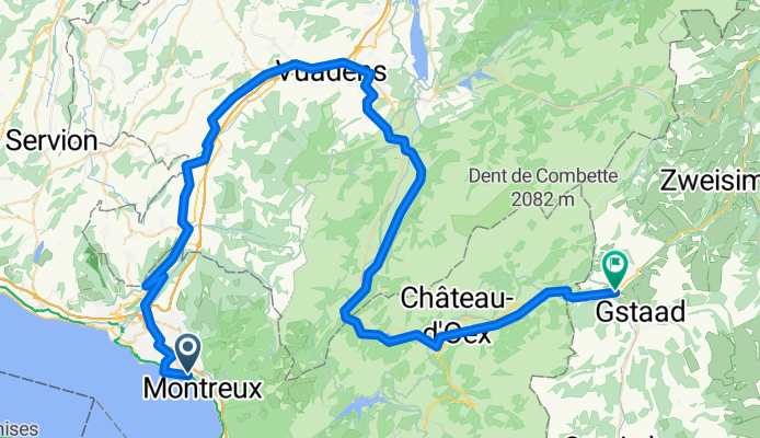
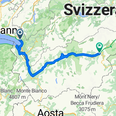
From Montreux to Saanen
A cycling route starting in Le Châtelard, Canton of Vaud, Switzerland.
Overview
About this route
- 5 h 14 min
- Duration
- 82.5 km
- Distance
- 1,736 m
- Ascent
- 1,095 m
- Descent
- 15.8 km/h
- Avg. speed
- 1,027 m
- Max. altitude

Part of
Szwajcaria 2026
13 stages
Route quality
Waytypes & surfaces along the route
Waytypes
Quiet road
54.8 km
(66 %)
Road
12 km
(15 %)
Surfaces
Paved
29.9 km
(36 %)
Unpaved
1.9 km
(2 %)
Asphalt
29 km
(35 %)
Unpaved (undefined)
0.7 km
(<1 %)
Continue with Bikemap
Use, edit, or download this cycling route
You would like to ride From Montreux to Saanen or customize it for your own trip? Here is what you can do with this Bikemap route:
Free features
- Save this route as favorite or in collections
- Copy & plan your own version of this route
- Split it into stages to create a multi-day tour
- Sync your route with Garmin or Wahoo
Premium features
Free trial for 3 days, or one-time payment. More about Bikemap Premium.
- Navigate this route on iOS & Android
- Export a GPX / KML file of this route
- Create your custom printout (try it for free)
- Download this route for offline navigation
Discover more Premium features.
Get Bikemap PremiumFrom our community
Other popular routes starting in Le Châtelard
 Freiburg - Nizza in 4 Tagen/Tag 2: Montreux - Val d'Isère
- Distance
- 215.3 km
- Ascent
- 4,237 m
- Descent
- 2,784 m
- Location
- Le Châtelard, Canton of Vaud, Switzerland
 Clarens Villeneuve Chexbres et retour par les hauts
- Distance
- 75.2 km
- Ascent
- 1,709 m
- Descent
- 1,711 m
- Location
- Le Châtelard, Canton of Vaud, Switzerland
 Montreux - Chateau de Chillon
- Distance
- 25.2 km
- Ascent
- 927 m
- Descent
- 924 m
- Location
- Le Châtelard, Canton of Vaud, Switzerland
 RHONSKOU STEZKOU NA KOLE-www.nomad.cz
- Distance
- 181.2 km
- Ascent
- 1,311 m
- Descent
- 1,056 m
- Location
- Le Châtelard, Canton of Vaud, Switzerland
 Clarens-La Guerce
- Distance
- 38.1 km
- Ascent
- 1,023 m
- Descent
- 37 m
- Location
- Le Châtelard, Canton of Vaud, Switzerland
 trasa NA KOLE OD ŽENEVSKÉHO JEZERA K MATTERHORNU
- Distance
- 117.1 km
- Ascent
- 1,240 m
- Descent
- 1,130 m
- Location
- Le Châtelard, Canton of Vaud, Switzerland
 Vers Chailly
- Distance
- 4 km
- Ascent
- 93 m
- Descent
- 93 m
- Location
- Le Châtelard, Canton of Vaud, Switzerland
 Chernex-Cerniaule
- Distance
- 9.5 km
- Ascent
- 768 m
- Descent
- 44 m
- Location
- Le Châtelard, Canton of Vaud, Switzerland
Open it in the app