
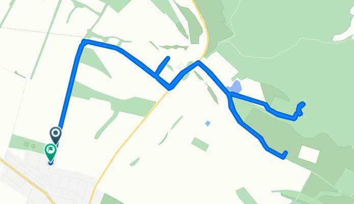
Iskola út, Érsekvadkert - Honvéd út, Érsekvadkert
A cycling route starting in Érsekvadkert, Nógrád megye, Hungary.
Overview
About this route
- 1 h 26 min
- Duration
- 16.5 km
- Distance
- 225 m
- Ascent
- 230 m
- Descent
- 11.5 km/h
- Avg. speed
- 208 m
- Max. altitude

Route photos


Route quality
Waytypes & surfaces along the route
Waytypes
Track
15.1 km
(92 %)
Quiet road
0.3 km
(2 %)
Undefined
1 km
(6 %)
Surfaces
Paved
1 km
(6 %)
Unpaved
3.5 km
(21 %)
Ground
2.5 km
(15 %)
Asphalt
1 km
(6 %)
Continue with Bikemap
Use, edit, or download this cycling route
You would like to ride Iskola út, Érsekvadkert - Honvéd út, Érsekvadkert or customize it for your own trip? Here is what you can do with this Bikemap route:
Free features
- Save this route as favorite or in collections
- Copy & plan your own version of this route
- Sync your route with Garmin or Wahoo
Premium features
Free trial for 3 days, or one-time payment. More about Bikemap Premium.
- Navigate this route on iOS & Android
- Export a GPX / KML file of this route
- Create your custom printout (try it for free)
- Download this route for offline navigation
Discover more Premium features.
Get Bikemap PremiumFrom our community
Other popular routes starting in Érsekvadkert
 Érsekvadkert - Penc- Nógrádkövesd- magyarnándor- Balassagyarmat - Érsekvadkert
- Distance
- 92.5 km
- Ascent
- 542 m
- Descent
- 541 m
- Location
- Érsekvadkert, Nógrád megye, Hungary
 Érsekvadkert -Pusztaberki- Horpács - Borsosberény . Nagyoroszi . Patak - Érsekvadkert
- Distance
- 26.2 km
- Ascent
- 194 m
- Descent
- 194 m
- Location
- Érsekvadkert, Nógrád megye, Hungary
 Szentlőrincpuszta - Nagyoroszi
- Distance
- 13.4 km
- Ascent
- 122 m
- Descent
- 50 m
- Location
- Érsekvadkert, Nógrád megye, Hungary
 Petőfi Sándor út 55, Érsekvadkert - 22 59, Érsekvadkert
- Distance
- 18.8 km
- Ascent
- 125 m
- Descent
- 125 m
- Location
- Érsekvadkert, Nógrád megye, Hungary
 Érsekvadkert- Bánk- Kétbodony -Érsekvadkert
- Distance
- 58.8 km
- Ascent
- 225 m
- Descent
- 225 m
- Location
- Érsekvadkert, Nógrád megye, Hungary
- Iskola út, Érsekvadkert - Honvéd út, Érsekvadkert
- Distance
- 16.5 km
- Ascent
- 225 m
- Descent
- 230 m
- Location
- Érsekvadkert, Nógrád megye, Hungary
 Érsekvadkeert - Romhány - Nőtincs - Nógrád - Rétság - Érsekvadkert
- Distance
- 57.5 km
- Ascent
- 323 m
- Descent
- 323 m
- Location
- Érsekvadkert, Nógrád megye, Hungary
 Érsekvadkert Rimóc Hollókő Mohora Érsekvadkert
- Distance
- 110.3 km
- Ascent
- 513 m
- Descent
- 514 m
- Location
- Érsekvadkert, Nógrád megye, Hungary
Open it in the app