
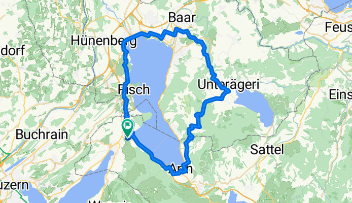
Birkenhof nach Birkenhof
A cycling route starting in Küssnacht, Canton of Schwyz, Switzerland.
Overview
About this route
- 2 h 34 min
- Duration
- 52.1 km
- Distance
- 1,299 m
- Ascent
- 1,302 m
- Descent
- 20.4 km/h
- Avg. speed
- 1,048 m
- Max. altitude
Route quality
Waytypes & surfaces along the route
Waytypes
Quiet road
20.3 km
(39 %)
Track
15.6 km
(30 %)
Surfaces
Paved
29.7 km
(57 %)
Unpaved
7.3 km
(14 %)
Asphalt
25 km
(48 %)
Paved (undefined)
4.2 km
(8 %)
Continue with Bikemap
Use, edit, or download this cycling route
You would like to ride Birkenhof nach Birkenhof or customize it for your own trip? Here is what you can do with this Bikemap route:
Free features
- Save this route as favorite or in collections
- Copy & plan your own version of this route
- Sync your route with Garmin or Wahoo
Premium features
Free trial for 3 days, or one-time payment. More about Bikemap Premium.
- Navigate this route on iOS & Android
- Export a GPX / KML file of this route
- Create your custom printout (try it for free)
- Download this route for offline navigation
Discover more Premium features.
Get Bikemap PremiumFrom our community
Other popular routes starting in Küssnacht
 Küssnacht-Vitznau-Ibergeregg-Einsiedeln-Arth-K.a.r.
- Distance
- 101.7 km
- Ascent
- 1,345 m
- Descent
- 1,340 m
- Location
- Küssnacht, Canton of Schwyz, Switzerland
 Michelskreuz
- Distance
- 33.7 km
- Ascent
- 612 m
- Descent
- 612 m
- Location
- Küssnacht, Canton of Schwyz, Switzerland
 Küssnacht Luzern Rotkreuz Küssnacht
- Distance
- 39.9 km
- Ascent
- 338 m
- Descent
- 329 m
- Location
- Küssnacht, Canton of Schwyz, Switzerland
 Küssnacht (Schwyz) to Loznica
- Distance
- 1,537.9 km
- Ascent
- 30,537 m
- Descent
- 30,851 m
- Location
- Küssnacht, Canton of Schwyz, Switzerland
 Route nach Sankt Immer
- Distance
- 139.8 km
- Ascent
- 2,902 m
- Descent
- 2,531 m
- Location
- Küssnacht, Canton of Schwyz, Switzerland
 TT_U-E16
- Distance
- 57.8 km
- Ascent
- 1,227 m
- Descent
- 926 m
- Location
- Küssnacht, Canton of Schwyz, Switzerland
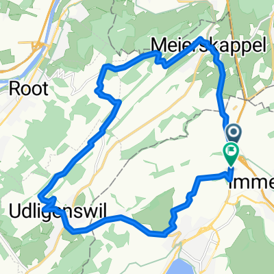 Meierskappel
- Distance
- 16.5 km
- Ascent
- 465 m
- Descent
- 459 m
- Location
- Küssnacht, Canton of Schwyz, Switzerland
 Immensee - Luzern - Rotkreuz - Immensee
- Distance
- 43.2 km
- Ascent
- 376 m
- Descent
- 376 m
- Location
- Küssnacht, Canton of Schwyz, Switzerland
Open it in the app