
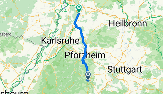
Overview
About this route
- 4 h 53 min
- Duration
- 79.9 km
- Distance
- 1,010 m
- Ascent
- 1,253 m
- Descent
- 16.4 km/h
- Avg. speed
- 394 m
- Max. altitude
Part of
Sulz - Stralsund
15 stages
Route quality
Waytypes & surfaces along the route
Waytypes
Track
32 km
(40 %)
Quiet road
29.6 km
(37 %)
Surfaces
Paved
67.9 km
(85 %)
Unpaved
0.8 km
(1 %)
Asphalt
61.5 km
(77 %)
Paved (undefined)
5.6 km
(7 %)
Continue with Bikemap
Use, edit, or download this cycling route
You would like to ride Calw - Kronau or customize it for your own trip? Here is what you can do with this Bikemap route:
Free features
- Save this route as favorite or in collections
- Copy & plan your own version of this route
- Sync your route with Garmin or Wahoo
Premium features
Free trial for 3 days, or one-time payment. More about Bikemap Premium.
- Navigate this route on iOS & Android
- Export a GPX / KML file of this route
- Create your custom printout (try it for free)
- Download this route for offline navigation
Discover more Premium features.
Get Bikemap PremiumFrom our community
Other popular routes starting in Calw
 Sonntag 1
- Distance
- 32.2 km
- Ascent
- 395 m
- Descent
- 404 m
- Location
- Calw, Baden-Wurttemberg, Germany
 ST Calw
- Distance
- 44.7 km
- Ascent
- 1,269 m
- Descent
- 1,211 m
- Location
- Calw, Baden-Wurttemberg, Germany
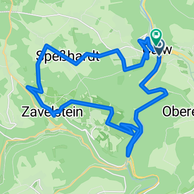
 Wasser-Wald- und Wiesenpfad Calw - Bad Teinach-Zavelstein
- Distance
- 13.3 km
- Ascent
- 297 m
- Descent
- 277 m
- Location
- Calw, Baden-Wurttemberg, Germany
 Von Calw zum Himmelsglück und über das Enztal
- Distance
- 45.2 km
- Ascent
- 854 m
- Descent
- 854 m
- Location
- Calw, Baden-Wurttemberg, Germany
 Calw-Bad-Wildbad-Altensteig-Nagold
- Distance
- 143.9 km
- Ascent
- 2,521 m
- Descent
- 2,463 m
- Location
- Calw, Baden-Wurttemberg, Germany
 stammheim, die 1.
- Distance
- 58 km
- Ascent
- 1,165 m
- Descent
- 1,250 m
- Location
- Calw, Baden-Wurttemberg, Germany
 Marktbrücke nach Marktplatz
- Distance
- 25.8 km
- Ascent
- 749 m
- Descent
- 744 m
- Location
- Calw, Baden-Wurttemberg, Germany
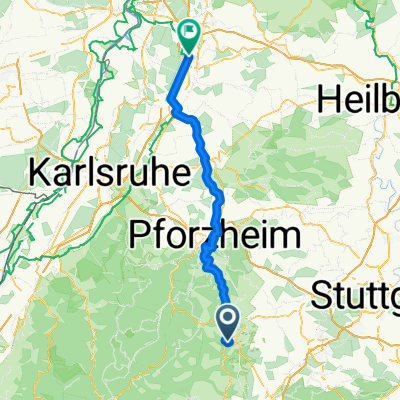 Calw - Kronau
- Distance
- 79.9 km
- Ascent
- 1,010 m
- Descent
- 1,253 m
- Location
- Calw, Baden-Wurttemberg, Germany
Open it in the app