

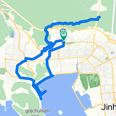
진영읍 ~ 진영읍 559-9
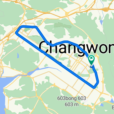
A cycling route starting in Changwon, Gyeongsangnam-do, South Korea.
Overview
About this route
- 1 h 54 min
- Duration
- 19 km
- Distance
- 122 m
- Ascent
- 117 m
- Descent
- 10 km/h
- Avg. speed
- 52 m
- Max. altitude

Continue with Bikemap
Use, edit, or download this cycling route
You would like to ride 진영읍 ~ 진영읍 559-9 or customize it for your own trip? Here is what you can do with this Bikemap route:
Free features
- Save this route as favorite or in collections
- Copy & plan your own version of this route
- Sync your route with Garmin or Wahoo
Premium features
Free trial for 3 days, or one-time payment. More about Bikemap Premium.
- Navigate this route on iOS & Android
- Export a GPX / KML file of this route
- Create your custom printout (try it for free)
- Download this route for offline navigation
Discover more Premium features.
Get Bikemap PremiumFrom our community
Other popular routes starting in Changwon
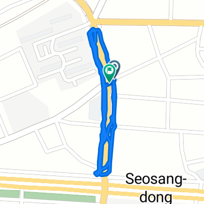 보통 경로
보통 경로- Distance
- 2.2 km
- Ascent
- 81 m
- Descent
- 107 m
- Location
- Changwon, Gyeongsangnam-do, South Korea
![하단동 1149-30Ph0]으로 라우팅](https://media.bikemap.net/routes/17681529/gallery/thumbs/d6447977-3b58-49ae-9fa9-7faab52285a4.jpg.208x208_q80_crop.jpg) 하단동 1149-30Ph0]으로 라우팅
하단동 1149-30Ph0]으로 라우팅- Distance
- 72.7 km
- Ascent
- 226 m
- Descent
- 261 m
- Location
- Changwon, Gyeongsangnam-do, South Korea
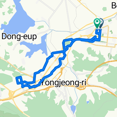
 팔용동 81-11 ~ 소답동 114-5
- Distance
- 26 km
- Ascent
- 123 m
- Descent
- 159 m
- Location
- Changwon, Gyeongsangnam-do, South Korea
 35.222, 128.675에서 35.232, 128.689까지
- Distance
- 9.2 km
- Ascent
- 103 m
- Descent
- 85 m
- Location
- Changwon, Gyeongsangnam-do, South Korea
 사파동 112-8 ~ 사파동 112-8
- Distance
- 25.8 km
- Ascent
- 152 m
- Descent
- 182 m
- Location
- Changwon, Gyeongsangnam-do, South Korea
 서재골공원 ~ 서재골공원
- Distance
- 17.6 km
- Ascent
- 82 m
- Descent
- 83 m
- Location
- Changwon, Gyeongsangnam-do, South Korea
 경화동 1280-6 ~ 경화동 1280-6
- Distance
- 17.7 km
- Ascent
- 396 m
- Descent
- 423 m
- Location
- Changwon, Gyeongsangnam-do, South Korea
 느린 주행
느린 주행- Distance
- 1.5 km
- Ascent
- 94 m
- Descent
- 126 m
- Location
- Changwon, Gyeongsangnam-do, South Korea
Open it in the app