

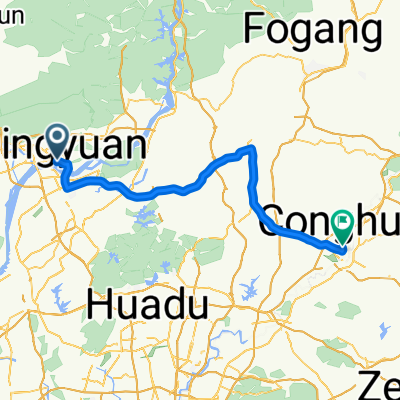
12.7.22清遠筆架山
A cycling route starting in Qingyuan, Guangdong, China.
Overview
About this route
Riding a Dahon folding bike uphill on off-road mountain trails – want to die!
- -:--
- Duration
- 49.6 km
- Distance
- 1,562 m
- Ascent
- 1,469 m
- Descent
- ---
- Avg. speed
- ---
- Max. altitude

Continue with Bikemap
Use, edit, or download this cycling route
You would like to ride 12.7.22清遠筆架山 or customize it for your own trip? Here is what you can do with this Bikemap route:
Free features
- Save this route as favorite or in collections
- Copy & plan your own version of this route
- Sync your route with Garmin or Wahoo
Premium features
Free trial for 3 days, or one-time payment. More about Bikemap Premium.
- Navigate this route on iOS & Android
- Export a GPX / KML file of this route
- Create your custom printout (try it for free)
- Download this route for offline navigation
Discover more Premium features.
Get Bikemap PremiumFrom our community
Other popular routes starting in Qingyuan
 清远十里竹廊+英西峰林走廊
- Distance
- 249.4 km
- Ascent
- 1,095 m
- Descent
- 1,103 m
- Location
- Qingyuan, Guangdong, China
 test
test- Distance
- 282.6 km
- Ascent
- 3,456 m
- Descent
- 3,412 m
- Location
- Qingyuan, Guangdong, China
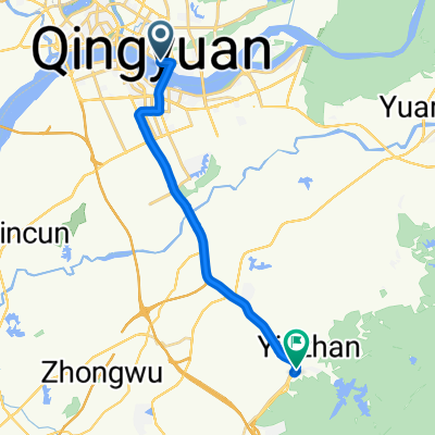
 DAY2清遠_從化
- Distance
- 79.1 km
- Ascent
- 443 m
- Descent
- 425 m
- Location
- Qingyuan, Guangdong, China
 清遠市新城汽車客運站 - 九龍鎮(迎賓館)
- Distance
- 71.2 km
- Ascent
- 1,070 m
- Descent
- 977 m
- Location
- Qingyuan, Guangdong, China
 清远市,英西峰林,阳山,连州,乳源,韶关
- Distance
- 394.6 km
- Ascent
- 3,355 m
- Descent
- 3,317 m
- Location
- Qingyuan, Guangdong, China
 20121021清遠
- Distance
- 21 km
- Ascent
- 71 m
- Descent
- 55 m
- Location
- Qingyuan, Guangdong, China
 清遠至沙河
清遠至沙河- Distance
- 53.5 km
- Ascent
- 651 m
- Descent
- 638 m
- Location
- Qingyuan, Guangdong, China
 清遠市長途汽車站→蘆苞鎮 58k→蘆苞祖廟61k
- Distance
- 63.1 km
- Ascent
- 59 m
- Descent
- 75 m
- Location
- Qingyuan, Guangdong, China
Open it in the app