

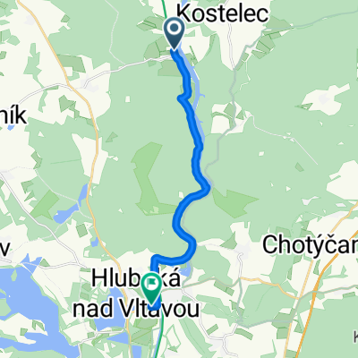
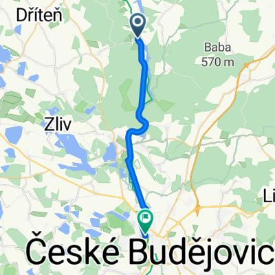
2012.07.18b - Temelín-Týn - básník
A cycling route starting in Dřiteň, Jihočeský kraj, Czechia.
Overview
About this route
Básník 18.7.2012 od Michaela domů
- -:--
- Duration
- 14.4 km
- Distance
- 108 m
- Ascent
- 235 m
- Descent
- ---
- Avg. speed
- ---
- Max. altitude
Route quality
Waytypes & surfaces along the route
Waytypes
Road
9.8 km
(68 %)
Quiet road
2.9 km
(20 %)
Surfaces
Paved
9.4 km
(65 %)
Asphalt
8.2 km
(57 %)
Concrete
1.2 km
(8 %)
Undefined
5 km
(35 %)
Continue with Bikemap
Use, edit, or download this cycling route
You would like to ride 2012.07.18b - Temelín-Týn - básník or customize it for your own trip? Here is what you can do with this Bikemap route:
Free features
- Save this route as favorite or in collections
- Copy & plan your own version of this route
- Sync your route with Garmin or Wahoo
Premium features
Free trial for 3 days, or one-time payment. More about Bikemap Premium.
- Navigate this route on iOS & Android
- Export a GPX / KML file of this route
- Create your custom printout (try it for free)
- Download this route for offline navigation
Discover more Premium features.
Get Bikemap PremiumFrom our community
Other popular routes starting in Dřiteň
 Úterý_do Kratochvíle
- Distance
- 14.8 km
- Ascent
- 58 m
- Descent
- 24 m
- Location
- Dřiteň, Jihočeský kraj, Czechia
 Cyklostezka Hluboká nad Vltavou - Poněšice CLONED FROM ROUTE 885162
- Distance
- 12.3 km
- Ascent
- 276 m
- Descent
- 269 m
- Location
- Dřiteň, Jihočeský kraj, Czechia
 ETE_Kometa_Selibov_Herman_Vodnany
- Distance
- 48 km
- Ascent
- 337 m
- Descent
- 448 m
- Location
- Dřiteň, Jihočeský kraj, Czechia
 ETE_Hrad_Svinětice_Vodňany
- Distance
- 44.7 km
- Ascent
- 342 m
- Descent
- 448 m
- Location
- Dřiteň, Jihočeský kraj, Czechia
 V pondělí do Temelína a zpět
- Distance
- 26.7 km
- Ascent
- 155 m
- Descent
- 154 m
- Location
- Dřiteň, Jihočeský kraj, Czechia
 2013_04 Temelín_Protivín pěšky
- Distance
- 17.2 km
- Ascent
- 276 m
- Descent
- 381 m
- Location
- Dřiteň, Jihočeský kraj, Czechia
 2014_11 Divcice_Protivin pěšky
- Distance
- 19.5 km
- Ascent
- 135 m
- Descent
- 148 m
- Location
- Dřiteň, Jihočeský kraj, Czechia
 2012.07.21b - Purkarec-ČB - evčas
- Distance
- 8.5 km
- Ascent
- 315 m
- Descent
- 314 m
- Location
- Dřiteň, Jihočeský kraj, Czechia
Open it in the app