

Bodenseeumfahrung
A cycling route starting in Koblenz, Canton of Aargau, Switzerland.
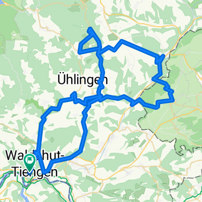
Overview
About this route
The Swiss side is great! The German side is pure chaos! Poorly signed or along a heavily trafficked road....
- -:--
- Duration
- 312.7 km
- Distance
- 538 m
- Ascent
- 538 m
- Descent
- ---
- Avg. speed
- ---
- Max. altitude

Route quality
Waytypes & surfaces along the route
Waytypes
Quiet road
87.5 km
(28 %)
Path
56.3 km
(18 %)
Surfaces
Paved
281.4 km
(90 %)
Unpaved
9.4 km
(3 %)
Asphalt
275.2 km
(88 %)
Paved (undefined)
6.3 km
(2 %)
Continue with Bikemap
Use, edit, or download this cycling route
You would like to ride Bodenseeumfahrung or customize it for your own trip? Here is what you can do with this Bikemap route:
Free features
- Save this route as favorite or in collections
- Copy & plan your own version of this route
- Split it into stages to create a multi-day tour
- Sync your route with Garmin or Wahoo
Premium features
Free trial for 3 days, or one-time payment. More about Bikemap Premium.
- Navigate this route on iOS & Android
- Export a GPX / KML file of this route
- Create your custom printout (try it for free)
- Download this route for offline navigation
Discover more Premium features.
Get Bikemap PremiumFrom our community
Other popular routes starting in Koblenz
 4 dag waltshut Lörrach
- Distance
- 58.9 km
- Ascent
- 463 m
- Descent
- 483 m
- Location
- Koblenz, Canton of Aargau, Switzerland
 Hausberg Maxi
- Distance
- 48.2 km
- Ascent
- 1,044 m
- Descent
- 1,041 m
- Location
- Koblenz, Canton of Aargau, Switzerland
 Zwei Täler und Hallau
- Distance
- 88.6 km
- Ascent
- 1,247 m
- Descent
- 1,247 m
- Location
- Koblenz, Canton of Aargau, Switzerland
 Route de l'Aar
- Distance
- 301.3 km
- Ascent
- 585 m
- Descent
- 280 m
- Location
- Koblenz, Canton of Aargau, Switzerland
 02. Etappe: Koblenz-Titisee
- Distance
- 53.1 km
- Ascent
- 764 m
- Descent
- 241 m
- Location
- Koblenz, Canton of Aargau, Switzerland
 Konstanz - Koblenz, neu
- Distance
- 121 km
- Ascent
- 316 m
- Descent
- 230 m
- Location
- Koblenz, Canton of Aargau, Switzerland
 Schaffhausen +
- Distance
- 101.1 km
- Ascent
- 858 m
- Descent
- 858 m
- Location
- Koblenz, Canton of Aargau, Switzerland
 6 Waldshut-Tiengen to Ossingen
- Distance
- 51.9 km
- Ascent
- 842 m
- Descent
- 774 m
- Location
- Koblenz, Canton of Aargau, Switzerland
Open it in the app