
my first ride on my Van Rysel gravel bike
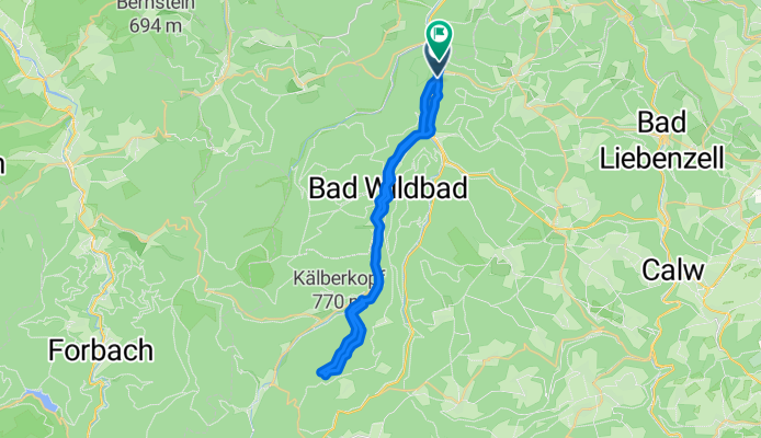
A cycling route starting in Höfen an der Enz, Baden-Wurttemberg, Germany.
Overview
About this route
- 3 h 42 min
- Duration
- 39.2 km
- Distance
- 936 m
- Ascent
- 989 m
- Descent
- 10.6 km/h
- Avg. speed
- 814 m
- Max. altitude
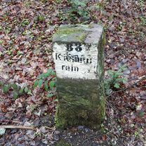
Route photos


Route quality
Waytypes & surfaces along the route
Waytypes
Track
23.1 km
(59 %)
Quiet road
8.6 km
(22 %)
Surfaces
Paved
20.4 km
(52 %)
Unpaved
14.5 km
(37 %)
Asphalt
16.1 km
(41 %)
Gravel
13.3 km
(34 %)
Continue with Bikemap
Use, edit, or download this cycling route
You would like to ride my first ride on my Van Rysel gravel bike or customize it for your own trip? Here is what you can do with this Bikemap route:
Free features
- Save this route as favorite or in collections
- Copy & plan your own version of this route
- Sync your route with Garmin or Wahoo
Premium features
Free trial for 3 days, or one-time payment. More about Bikemap Premium.
- Navigate this route on iOS & Android
- Export a GPX / KML file of this route
- Create your custom printout (try it for free)
- Download this route for offline navigation
Discover more Premium features.
Get Bikemap PremiumFrom our community
Other popular routes starting in Höfen an der Enz
 Calmbach
- Distance
- 41.2 km
- Ascent
- 650 m
- Descent
- 650 m
- Location
- Höfen an der Enz, Baden-Wurttemberg, Germany
 test
test- Distance
- 5.5 km
- Ascent
- 147 m
- Descent
- 147 m
- Location
- Höfen an der Enz, Baden-Wurttemberg, Germany
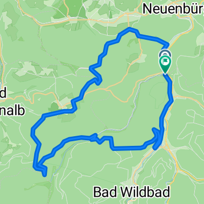 Route in Neuenbürg
- Distance
- 36 km
- Ascent
- 1,219 m
- Descent
- 1,221 m
- Location
- Höfen an der Enz, Baden-Wurttemberg, Germany
 Calmbach Meistern Poppeltal
- Distance
- 54.1 km
- Ascent
- 989 m
- Descent
- 991 m
- Location
- Höfen an der Enz, Baden-Wurttemberg, Germany
 Bad Wildbad-BadenBaden-KaltenbronnerWand
- Distance
- 90.1 km
- Ascent
- 1,720 m
- Descent
- 1,720 m
- Location
- Höfen an der Enz, Baden-Wurttemberg, Germany
 Neuenbürg (Württ.) Eyachbrücke nach Neuenbürg Südbahnhof
- Distance
- 19.2 km
- Ascent
- 136 m
- Descent
- 167 m
- Location
- Höfen an der Enz, Baden-Wurttemberg, Germany
 Kaltenbronn Wi
- Distance
- 65.5 km
- Ascent
- 1,699 m
- Descent
- 1,617 m
- Location
- Höfen an der Enz, Baden-Wurttemberg, Germany
 Von der Enz zur Murg - Höfen-Dobel-Gernsbach-Kaltenbronner Wand-Wildbad-Höfen.gpx
- Distance
- 65.8 km
- Ascent
- 1,276 m
- Descent
- 1,272 m
- Location
- Höfen an der Enz, Baden-Wurttemberg, Germany
Open it in the app