
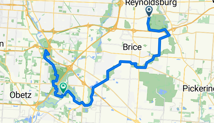
E Livingston Ave, Reynoldsburg to Bixby Rd, Columbus
A cycling route starting in Reynoldsburg, Ohio, United States.
Overview
About this route
- 2 h 7 min
- Duration
- 34.5 km
- Distance
- 72 m
- Ascent
- 119 m
- Descent
- 16.4 km/h
- Avg. speed
- 273 m
- Max. altitude
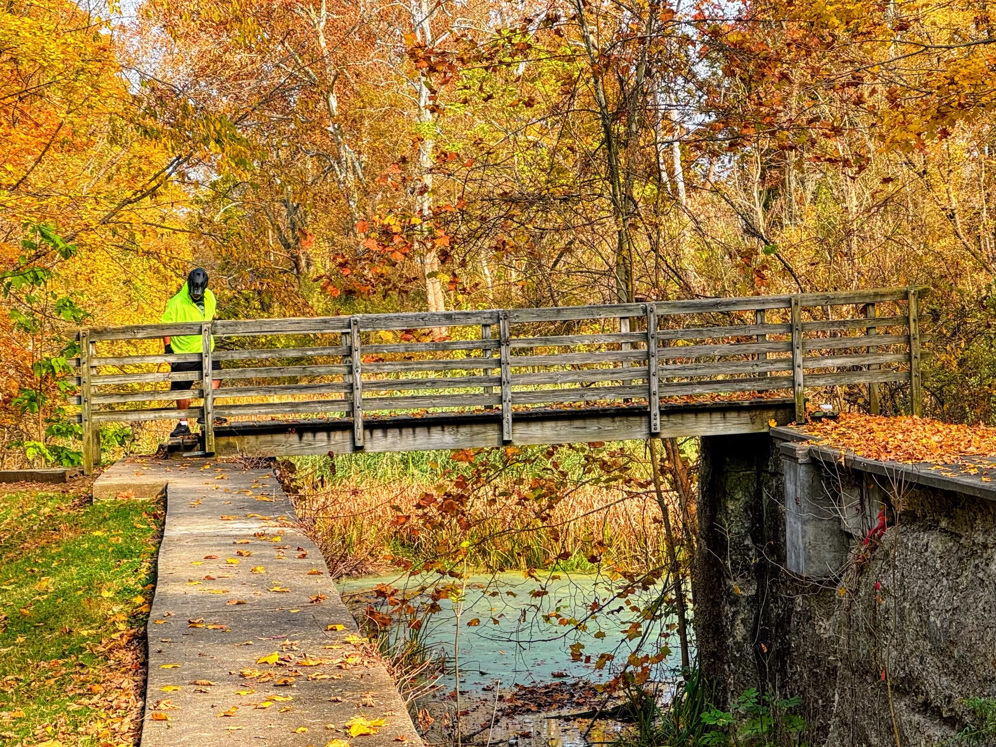
Route photos

Route quality
Waytypes & surfaces along the route
Waytypes
Cycleway
34.3 km
(99 %)
Path
0.1 km
(<1 %)
Surfaces
Paved
32.5 km
(94 %)
Unpaved
1.9 km
(5 %)
Asphalt
32.2 km
(93 %)
Gravel
1.7 km
(5 %)
Continue with Bikemap
Use, edit, or download this cycling route
You would like to ride E Livingston Ave, Reynoldsburg to Bixby Rd, Columbus or customize it for your own trip? Here is what you can do with this Bikemap route:
Free features
- Save this route as favorite or in collections
- Copy & plan your own version of this route
- Sync your route with Garmin or Wahoo
Premium features
Free trial for 3 days, or one-time payment. More about Bikemap Premium.
- Navigate this route on iOS & Android
- Export a GPX / KML file of this route
- Create your custom printout (try it for free)
- Download this route for offline navigation
Discover more Premium features.
Get Bikemap PremiumFrom our community
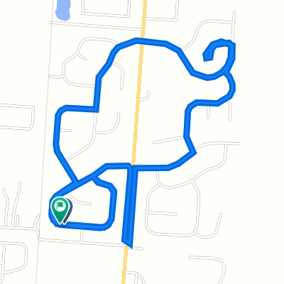
Other popular routes starting in Reynoldsburg
 Meijer 20 miler
- Distance
- 16.1 km
- Ascent
- 34 m
- Descent
- 86 m
- Location
- Reynoldsburg, Ohio, United States
 39.916° N -82.805° W to 39.916° N -82.805° W
- Distance
- 6.5 km
- Ascent
- 19 m
- Descent
- 19 m
- Location
- Reynoldsburg, Ohio, United States
 Stonemast Loop 194, Pataskala to Stonemast Loop 194, Pataskala
- Distance
- 5.1 km
- Ascent
- 39 m
- Descent
- 3 m
- Location
- Reynoldsburg, Ohio, United States
 East Livingston Avenue 6711, Reynoldsburg to East Livingston Avenue 6711, Reynoldsburg
- Distance
- 3.4 km
- Ascent
- 25 m
- Descent
- 27 m
- Location
- Reynoldsburg, Ohio, United States
 10 miler
- Distance
- 15.8 km
- Ascent
- 61 m
- Descent
- 34 m
- Location
- Reynoldsburg, Ohio, United States
 tussing rd.
- Distance
- 11.7 km
- Ascent
- 153 m
- Descent
- 140 m
- Location
- Reynoldsburg, Ohio, United States
 12127–12833 Tussing Rd, Columbus to 2800 Salem Hills Ct, Columbus
- Distance
- 3.6 km
- Ascent
- 19 m
- Descent
- 20 m
- Location
- Reynoldsburg, Ohio, United States
- E Livingston Ave, Reynoldsburg to Bixby Rd, Columbus
- Distance
- 34.5 km
- Ascent
- 72 m
- Descent
- 119 m
- Location
- Reynoldsburg, Ohio, United States
Open it in the app