
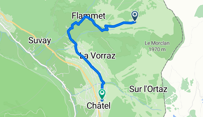
Châtel à Route du Centre, Châtel
A cycling route starting in Vionnaz, Valais, Switzerland.
Overview
About this route
- 18 min
- Duration
- 4.2 km
- Distance
- 28 m
- Ascent
- 441 m
- Descent
- 14.3 km/h
- Avg. speed
- 1,608 m
- Max. altitude
Route quality
Waytypes & surfaces along the route
Waytypes
Track
2.2 km
(51 %)
Quiet road
2.1 km
(49 %)
Surfaces
Paved
1.7 km
(40 %)
Unpaved
2.1 km
(50 %)
Asphalt
1.7 km
(40 %)
Gravel
1.7 km
(40 %)
Continue with Bikemap
Use, edit, or download this cycling route
You would like to ride Châtel à Route du Centre, Châtel or customize it for your own trip? Here is what you can do with this Bikemap route:
Free features
- Save this route as favorite or in collections
- Copy & plan your own version of this route
- Sync your route with Garmin or Wahoo
Premium features
Free trial for 3 days, or one-time payment. More about Bikemap Premium.
- Navigate this route on iOS & Android
- Export a GPX / KML file of this route
- Create your custom printout (try it for free)
- Download this route for offline navigation
Discover more Premium features.
Get Bikemap PremiumFrom our community
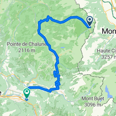
Other popular routes starting in Vionnaz
 Raq. Petit Chatel
- Distance
- 5.2 km
- Ascent
- 453 m
- Descent
- 25 m
- Location
- Vionnaz, Valais, Switzerland
 Les Portes du Soleil en gravel
- Distance
- 54.4 km
- Ascent
- 1,681 m
- Descent
- 1,672 m
- Location
- Vionnaz, Valais, Switzerland
 FR Châtel - Auf und Ab an die Türen Genfs
- Distance
- 90 km
- Ascent
- 1,135 m
- Descent
- 1,788 m
- Location
- Vionnaz, Valais, Switzerland
 2019_Francia_2_Châtel-La Clusaz
- Distance
- 130.3 km
- Ascent
- 2,355 m
- Descent
- 2,461 m
- Location
- Vionnaz, Valais, Switzerland
 Châtel - Cluses
- Distance
- 77.6 km
- Ascent
- 2,029 m
- Descent
- 2,722 m
- Location
- Vionnaz, Valais, Switzerland
 Col de Bassachaux
- Distance
- 13.3 km
- Ascent
- 667 m
- Descent
- 140 m
- Location
- Vionnaz, Valais, Switzerland
 Muraz (Collombey) to Route de Savolar, Muraz (Collombey)
- Distance
- 0.7 km
- Ascent
- 0 m
- Descent
- 3 m
- Location
- Vionnaz, Valais, Switzerland
 Chatel-Oyonnaz
- Distance
- 196.7 km
- Ascent
- 1,909 m
- Descent
- 2,561 m
- Location
- Vionnaz, Valais, Switzerland
Open it in the app